The Gilded Age, roughly from the late 1870s to the late 1890s, was an era of economic expansion and technological advance in which American industrial tycoons made massive fortunes. New elites competed to define their place in a society in flux, giving rise to an obsessive craving for status.
The desire for validation manifested itself in the building of mansions that mimicked castles or palaces. Their owners toured European capitals, ordering paintings and antiquities to decorate these grand homes.
They founded or funded museums, libraries, and concert halls to assert cultural refinement. Chasing family prestige, they exchanged daughters and dowries for the prestige of dusty European titles.
Cash for Coronets
When the American Norwegian sociologist Thorstein Veblen published The Theory of the Leisure Class in 1899, he introduced the term “conspicuous consumption” which pointed at a tendency amongst members of America’s “nouveau riche” to signal status by indulging in colossal spending.
Their public persona displayed the paradox of financial dominance and cultural inferiority. Despite control over a thriving economy, money makers suffered deep-seated insecurities, viewing the old-world European gentry as a prime cultural standard.
There were internal roadblocks too. Gatekeepers of “Old Money” such as Caroline Astor (organizer of “The Four Hundred”) guarded Manhattan’s established elite by shunning those who had assembled riches more recently.
Looking to compensate for this exclusion, social climbers were willing to “buy” rank instead. The troubled state of Europe’s aristocracy offered an opportunity.
During the late nineteenth century, time-honored noble families faced cash flow problems because of the Great Agricultural Depression (1873-1896), rising taxes, and the mounting cost of running ancestral estates. Fortunes crumbled and properties fell into disrepair.
In contrast, America’s upper crust had mountains of dollars to spare but lacked pedigree. Cash-strapped aristocrats traded ancient titles and hereditary seats with self-made tycoons. In the process, they surrendered the sacred notions of “blue blood” and “pure” ancestry.
The cross brought about transactional marital arrangements. Magnates in rail, steel, finance, or retail, exchanged daughter and dowry for the sake of a title.
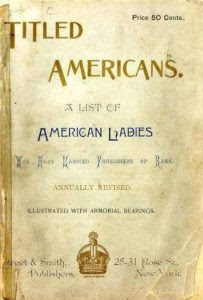
The publication’s “stud book” section was a match-making catalogue for affluent families, listing eligible bachelors with their titles and properties. The 1915 edition documented 454 women who had married into European nobility during the Gilded Age, over one hundred of them to British peers.
The phenomenon made an impact, injecting billions of pounds into the British economy, but transatlantic unions were controversial on both sides of the pond. British critics feared that such arrangements would pollute the nation’s peerage. President Theodore Roosevelt was not keen either.
In 1906, writing to Whitelaw Reid, American ambassador to Britain, he expressed his dislike of marriages that were based on the “sale of the girl for her money and the purchase of the man for his title.”
Once they had crossed the Atlantic, young brides experienced a culture shock. Raised in mansions with the comfort of modern amenities, they found themselves trapped in crumbling estates and stuck in loveless marriages.
Husbands routinely kept mistresses, leaving their partners to deal with the pain of loneliness and the disdain of in-laws. These newlyweds were commodities, caught between social ambition at home and class snobbery in their new surroundings.
Dollar Princess
Payments for prestige was a vogue associated particularly with British peers, but the trend applied to Continental nobles as well. In Italy, impoverished Princes, Dukes, and Counts (and there were plenty of them) faced the strain of managing impressive palazzos and art collections. American brides provided the cash infusion to preserve these estates.
Jennie Enfield Berry was one of them. Born in 1861, she grew up at the Oak Hill estate in Rome, Georgia. In 1889, she married Henry Bruton, a Nashville tobacco manufacturer. On his death in 1892, she inherited a fortune.
While traveling in Europe, she met Prince Enrico Ruspoli, a young man with title and charm, but little else. In 1901, the twenty-three-year-old noble followed the forty-year-old widow to Georgia and proposed to her.
Following their marriage in Washington, she moved to Rome, converted to Catholicism, and changed her name to Princess Eugenia Ruspoli. She used her wealth to restore Palazzo Ruspoli, a massive former medieval monastery at Nemi, southeast of Rome.
After Enrico’s premature death in 1909, he left the estate to his brother. Eugenia fought the family in court, winning her case in 1916. She decorated the palace with Renaissance and Baroque paintings, furniture, and antiquities. Before the outbreak of the Second World War, she took part of the valuable collection back to the United States.
Nonnie May (Nancy) Stewart was born in January 1878 in Zanesville, Ohio. She became known as the “Tin Plate Heiress” in 1908, after inheriting a fortune from her second husband, William Bateman Leeds.
Having met Christopher, Prince of Greece and Denmark, in 1914 at the French resort of Biarritz, the couple married in January 1920 in Vevey, Lake Geneva. She converted to the Greek Orthodox Church and changed her name to HRH Princess Anastasia, making her the aunt-by-marriage of Prince Philip, the future Duke of Edinburgh, husband of Queen Elisabeth II.
On January 17, 1908, a crowd gathered outside the Vanderbilt mansion on Manhattan’s 57th Street to watch guests arrive for the society event of the year, the wedding of Gladys Moore Vanderbilt to Count László Széchenyi, a distinguished noble in the Austro-Hungarian monarchy.
The two had met in 1907 in Berlin. Soon afterwards, just before her twenty-first birthday, Gladys inherited a fortune from her late father, railroad magnate Cornelius Vanderbilt II who had died in 1899. She became a (financial) fixture of the Imperial Court in Vienna.
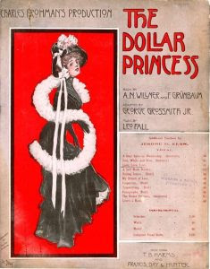
Public fascination with such transatlantic unions inspired an extraordinary musical occasion. Leo Fall was born in February 1873 at Olomouc, Moravia, into a family of musicians. Having studied at the Vienna Conservatory, he moved to Berlin to start a career as a composer of (twenty-two) operettas.
On November 2, 1907, the premiere took place in Vienna of Die Dollarprinzessin. The work became an instant hit, triumphing in Berlin in 1908. The launch of the English-language version The Dollar Princess on Broadway took place in August 1909 and ran for 288 performances.
In London, the musical play opened at Daly’s Theatre in Cranbourn Street (just off Leicester Square) in September 1909, running for 428 performances.
The phenomenon of American women marrying into European nobility peaked between 1870 and 1914. The phrase “Dollar Princess” became cemented into journalistic and social vocabulary after the operetta’s impact on both sides of the Atlantic.
Heir & Spare
Jennie Jerome was (probably) the first in a lengthy line of dollar princesses. Born in Brooklyn in 1854 to Wall Street speculator Leonard Jerome, she was an intelligent socialite and trendsetter.
In August 1873, she met twenty-four-year-old Lord Randolph Churchill, the younger son of the Duke of Marlborough, at a regatta on the Isle of Wight. He fell for her at first sight and, to his parents’ dismay, the couple were engaged three days later.
The prospect of a British noble marrying the daughter of a New York social climber was too abhorrent to contemplate – until they learned about the size of the dowry.
Jennie poured her energy in steering the military and political career of her eldest son, Winston Churchill. The marriage itself was distant and cold. Both were involved in affairs, with Jennie’s lovers including the Prince of Wales (the future King Edward VII) and King Milan I of Serbia.
Following Lord Randolph’s death in 1895, she shocked Victorian society by marrying twice more to partners two decades her junior.
Consuelo Vanderbilt, daughter of the railroad tycoon and Jockey Club founder William Kissam Vanderbilt and his wife Alva, married Charles Spencer-Churchill, 9th Duke of Marlborough, in 1895.
Alva had pushed hard for this match. Viewing her daughter as an extension of the family’s social ambitions, she was determined to secure a prestige wedding. The marriage was unhappy and loveless.
On their honeymoon, Charles told Consuela that he had married her because of his obligation “to save Blenheim,” his crumbling ancestral palace in Oxfordshire. After the birth of two sons in 1897/8, securing the line of succession, she reportedly coined the phrase “an heir and a spare” (the bride’s primary duty was to give birth to an heir to the title as well as second “spare” son, just in case). The couple spent years living apart before separating in 1906.
Mary Victoria Leiter, daughter of Chicago retail magnate Levi Ziegler Leiter, was born in May 1870. A six-foot-tall and well-educated debutante, she met politician George Nathaniel Curzon in 1890.
Married five years later, she assumed the name Mary Curzon, Baroness Curzon of Kedleston. When George was appointed Viceroy of India in 1898, she took charge of managing imperial courts, galas, and official pageantry. She held the highest social rank reached by an American woman in the history of the British Empire.
Her younger sister Margaret “Daisy” Leiter was a celebrated beauty. Visiting Mary in India in 1903, she met Henry Howard, 19th Earl of Suffolk, and they were married a year later.
Daisy helped restoring the Earl’s estate Charlton Park, Wiltshire, to its former glory. After her husband was killed in action in April 1917 during the First World War, she split her time between Britain and Tucson, Arizona.
Upon her death in 1968, she left a fine collection of paintings to the British nation (the “Suffolk Collection” is on display at Kenwood House, London).
Money & Grand Style
America was winning the economic battle of the Industrial Revolution during the Gilded Age, but it yielded to Europe in the hierarchy of cultural prestige. Transatlantic marriages captured the public’s imagination and novelists recorded the social phenomenon firsthand.
It inspired Henry James in 1904 to draft the novel The Golden Bowl which features an impoverished Italian noble engaged to an American heiress.
An observer of New York’s high society, Edith Wharton captured the nuance of marital transactions. Her 1913 masterpiece The Custom of the Country explored the relentless social climbing that drove these unions.
In her unfinished final novel, The Buccaneers (1938), she pictured a group of American young women who leave for London to “secure” titles. But it was an expat portrait painter who personified the era’s elite social climate.
John Singer Sargent was born on January 12, 1856, in Florence. His father was a medical doctor who had practiced in Philadelphia, but in 1854 the family decided to settle in Europe.
A multi-lingual cosmopolitan, John studied briefly at the Accademia delle Belle Arti in Florence, before leaving for Paris at the age of eighteen where he enrolled at the École des Beaux-Arts.
He began his career as a portraitist in Paris, but by 1886 he had moved to London where he settled in James McNeill Whistler’s old studio at 13 Tite Street, Chelsea.
In the late 1880s he made two successive trips to the United States. He traveled to New York City in September 1887 (only the second time he had crossed the Atlantic) to paint the portrait of Henry Marquand’s wife at their summer home in Newport, Rhode Island.
He received an enthusiastic welcome in Boston where, in 1888, he opened his first one man-show at the prestigious St Botolph Club.
In London he became the chosen portraitist of Dollar Princesses. Obsessed with catching the shine of jewelry in paint, he turned to Netherlandish masters like Jan van Eyck, Peter Paul Rubens, or Johannes Vermeer, meticulously studying their methods.
Having learned how to depict the texture of silks, satin, velvet, and diamonds, he became the chronicler of consumer luxury. He used his skills to produce dozens of works in the style of eighteenth-century “swagger” portraits that were designed to project the female subject’s wealth, elegance, and status.
They include a portrait (1884) of Boston-born Edith Russell who entered British elite society in 1878 as Edith, Lady Playfair, after marrying the Scottish chemist and Liberal politician Lyon Playfair, 1st Baronet Playfair.
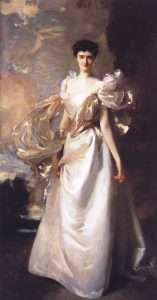
In 1898, Singer painted a full-length portrait of nineteen-year-old Daisy Leiter before she married Henry Howard, presenting her as an American scion about to enter British high society. Commissioned by her parents, this masterpiece captured the grace of a sitter who was said by her contemporaries to have the “loveliest eyes in Washington.”
In 1904, the artist portrayed the former Mary Crowninshield Endicott of Massachusetts who married Liberal politician Joseph Chamberlain, thus becoming stepmother to Neville, the future Prime Minister.
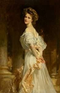
Four years later, Sargent was at Cliveden House, Buckinghamshire, to paint a portrait of Viscountess Astor, born Nancy Witcher Langhorne in Danville, Virginia. She would become the first female Member of Parliament to take a seat in the House of Commons in 1919, representing Plymouth for the Unionist (Conservative) Party.
John Singer Sargent was the chronicler of consumer luxury. The visual biographer of his era, his career was inextricably linked to the accumulation of riches. At times, there are hints at the vulnerability and isolation of his (female) sitters, but he never questioned immense wealth itself. Social concern was not on his price list.
In Britain, dollar dowries prevented the collapse of major country estates. The outbreak of war in 1914 gave some Dollar Princesses an opportunity to redefine their roles in society, providing medical care for wounded soldiers, drumming up American political and financial support for the Allied cause, and helping to foster transatlantic alliances.
The devastation of the war reshaped the global socio-political landscape and effectively brought the Dollar Princess era to a close.
PHOTO OF THE DAY
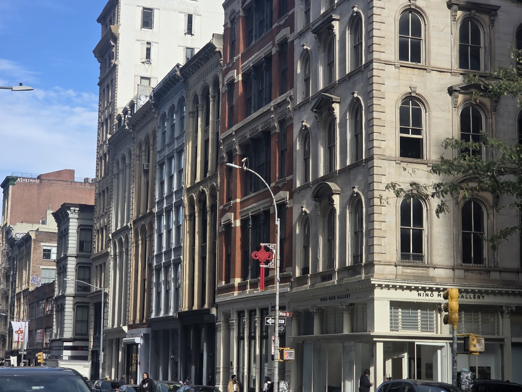
SOHO- THE BEST PRESERVED LANDMARK DISTRICT
CREDIT
NEW YORK ALMANACK
All image are copyrighted (c) Roosevelt Island Historical Society unless otherwise indicated THIS PUBLICATION FUNDED BY DISCRETIONARY FUNDS FROM CITY COUNCIL MEMBER JULIE MENIN & ROOSEVELT ISLAND OPERATING CORPORATION PUBLIC PURPOSE FUNDS.
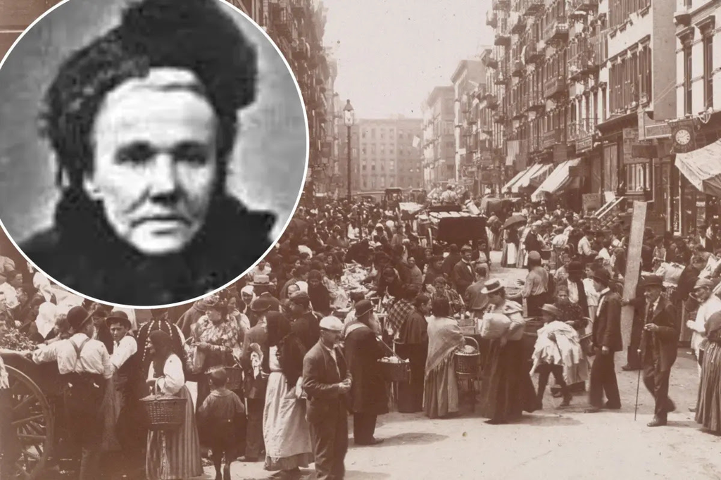
She operated from the Lower East Side and dined with the Gilded Age Millionaires
Fredericka “Marm” Mandelbaum (March 25, 1825 – February 26, 1894)[1][2][3] operated as a criminal fence to many of the street gangs and criminals of New York‘s underworld, handling between $1–5 million in stolen goods between 1862 and 1884. Like her principal rival John D. Grady and the Grady Gang, she also became a matriarch to the criminal elements of the city and was involved in financing and organizing numerous burglaries and other criminal operations throughout the post-American Civil War era.[4] With George Leonidas Leslie, she was involved in the 1869 Ocean National Bank robbery and the 1878 Manhattan Savings Institution robbery. Life and career
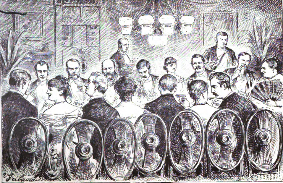
A typical dinner party hosted by Mandelbaum and her “inner circle”. Mandelbaum was born Friederike Weisner in Kassel, a city in modern-day Germany. Not much is known of her early life, other than that her family was Jewish. She married Wolfe Mandelbaum in 1848; they worked as itinerant peddlers in Germany before emigrating to the United States in 1850.[1] When the family arrived in New York, they began a series of small businesses, taking in goods collected by scavengers and reselling them. The pair purchased a dry goods store on Clinton Street, but by 1854, the business was operating as a front for the Mandelbaums’ criminal operations (she would later need to store goods in two large warehouses in the city). Mandelbaum began financing thieves and burglars and was involved in planning some of the biggest thefts in the city’s history, including the Ocean National Bank.[5] Expanding her operations, she controlled several gangs of blackmailers and confidence men as well as a school, known as Marm’s Grand Street School, to recruit and teach younger criminals how to pickpocket.[6] She was also a top competitor to the Grady Gang. According to police inspector Thomas Byrnes in his 1886 book Professional Criminals of America, Mandelbaum’s known associates included “burglar” Michael Kurtz, “pickpocket” Abraham Greenthall, “pickpocket, sneak, and shoplifter” Mary Hollbrook, and “Pickpocket and Blackmailer” Sophie Levy (or Lyons), often called Mandelbaum’s special protégé. Mandelbaum was reputedly loyal to her criminal associates. Chief of Police George W. Walling wrote, “She attained a reputation as a business woman whose honesty in criminal matters was absolute,” while The New York Times obituary noted: “her success was in a great measure due to her friendship for and her loyalty to the thieves with whom she did business. She never betrayed her clients, and when they got into trouble she procured bail for them and befriended them to the extent of her power”. For 30 years, she operated her business with impunity, as Walling highlighted her widespread influence and ingenuity in assisting criminals. Much of what is known about Mandelbaum comes from Walling’s 1887 Recollections of a New York Chief of Police and Sophie Lyons’ 1913 memoir Why Crime Does Not Pay, which details Mandelbaum’s operations, including a hidden dumbwaiter for stolen goods.[7] She was known for meticulously bribing and paying off police, local politicians, and judges.[8] Mandelbaum also became one of New York’s most prominent hostesses of New York’s high society, as well as the underworld, regularly associating with some of the most well-known criminals of the day including Queen Liz, Big Mary, “Black” Lena Kleinschmidt, Adam Worth, Sophie Lyons, and George Leonidas Leslie as well as judges and police officials.[citation needed] Mandelbaum’s preferred items were bolts of silk and diamonds, which she could acquire inexpensively and sell at a significant profit. However, she accepted anything of value. “Following the Great Chicago Fire, someone showed up at her haberdashery shop with a herd of goats they’d stolen during the fire, and she took them,” says J. North Conway, author of Queen of Thieves: The True Story of ‘Marm’ Mandelbaum and Her Gangs of New York.[8] Mandelbaum’s notoriety frequently placed her in the public eye. Her increasing infamy led to numerous mentions and quotes in newspapers, and her ostentatious display of wealth made her a notable and recognizable character. She was 6 feet tall and said to weigh between 200 and 300 pounds, giving her an imposing physical presence.[8] Mandelbaum often adorned herself with $40,000 worth of jewels and dressed in luxurious materials such as silk, ostrich feathers, and sealskin, making her “hard to miss”.[9] Arrest In 1884, New York City’s new District Attorney Peter B. Olney, described by The New York Times as “an eccentric person who honestly means to do his duty and enforce the laws,” decided to act against Mandelbaum. Instead of relying on the city’s police force, which Mandelbaum had reportedly been bribing for decades, he hired the Pinkerton Detective Agency, led by Robert A. Pinkerton, to conduct a sting operation.[7]
Pinkerton detective Gustav Frank, using the pseudonym Stein, infiltrated her inner circle. He eventually purchased “marked” silks from her. Her arrest in July and subsequent case received extensive coverage from major New York newspapers, intrigued by the downfall of such a notorious criminal. The use of Pinkerton detectives caused some friction between the district attorney’s office and the city’s police inspector.[7] At the time of her arrest, Mandelbaum had attorneys William F. Howe and Abraham Hummel on retainer for $5,000 a year. Howe and Hummel argued for her innocence and attempted to discredit Gustav Frank, implying he was a criminal. Bail was set at $10,000 ($2,000 for each of five charges). Despite round-the-clock surveillance by Pinkerton detectives, Mandelbaum failed to appear in court on December 4. The New York Times described the scene: “District Attorney Olney sat, sternly imposing…Mr. Howe was plumply serene and ponderously gracious… ‘Frederika Mandelbaum!’…The words seemed to float over the heads of the merchants and lose themselves. There was no answer. Dead silence reigned…Then a little sound of something like disappointment was heard in the court, and Lawyer Howe rose to his feet. ‘The defendants are not here, your Honor.’”[7] Later life and death The next day, the New York press located Mandelbaum in Canada. At the time there was no extradition treaty between Canada and the United States, so she lived out her remaining years there, despite expressing regret over leaving New York, once telling a reporter, “I am sorry that I ever left New-York, I should have faced the music.”[7] Mandelbaum died in 1894. Her death generated another wave of headlines, with some reports suggesting that she was not actually deceased and that her coffin contained stones. Other sources reported that several pockets were picked at the cemetery.[7] Public image Mandelbaum was nicknamed in the New York press as “Mother” Mandelbaum. The origins of this nickname are speculative. The press may have found irony in calling a woman, often described with antisemitic overtones as “a German Jewess with large, coarse features, almost masculine in appearance, restless black eyes, and a dark, florid complexion,” “Mother.” Other explanations include her protective nature towards criminals and her role as a devoted mother of four.[7] Mandelbaum has been described as “a kind of folk anti-hero, winning the grudging admiration of her foes”.[7] The Brooklyn Daily Eagle described Mandelbaum, possibly with a hint of irony, as “a most respectable and philanthropic receiver of stolen goods in New York.”[7]
Biographies
Footnotes are available on the Wikipedia website.
PHOTO OF THE DAY
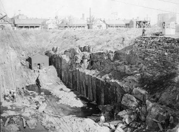
Remains of Quarry south of Cottage Row Across from Blackwell House in the 1920’s
Photo below is prisoners in Quarry.
CREDIT
Wikipedia Judith Berdy
All image are copyrighted (c) Roosevelt Island Historical Society unless otherwise indicated THIS PUBLICATION FUNDED BY DISCRETIONARY FUNDS FROM CITY COUNCIL MEMBER JULIE MENIN & ROOSEVELT ISLAND OPERATING CORPORATION PUBLIC PURPOSE FUNDS.
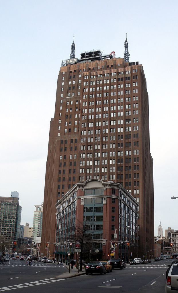
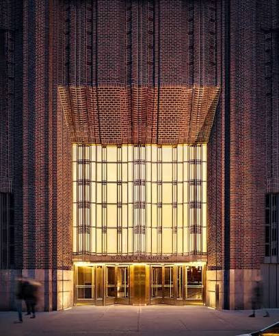
32 Avenue of the Americas (also known as the AT&T Long Lines Building, AT&T Building, or 32 Sixth Avenue) is a 27-story, 549-foot-tall (167 m) telecommunications building in the Tribeca neighborhood of Manhattan in New York City. Completed in 1932, it was one of several Art Deco–style telecommunications buildings designed by Ralph Thomas Walker of Voorhees, Gmelin and Walker in the early 20th century. 32 Avenue of the Americas spans the entire block bounded by Walker Street, Lispenard Street, Church Street, and Avenue of the Americas (also known as Sixth Avenue).
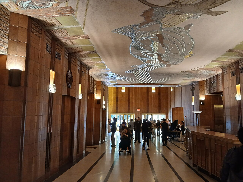
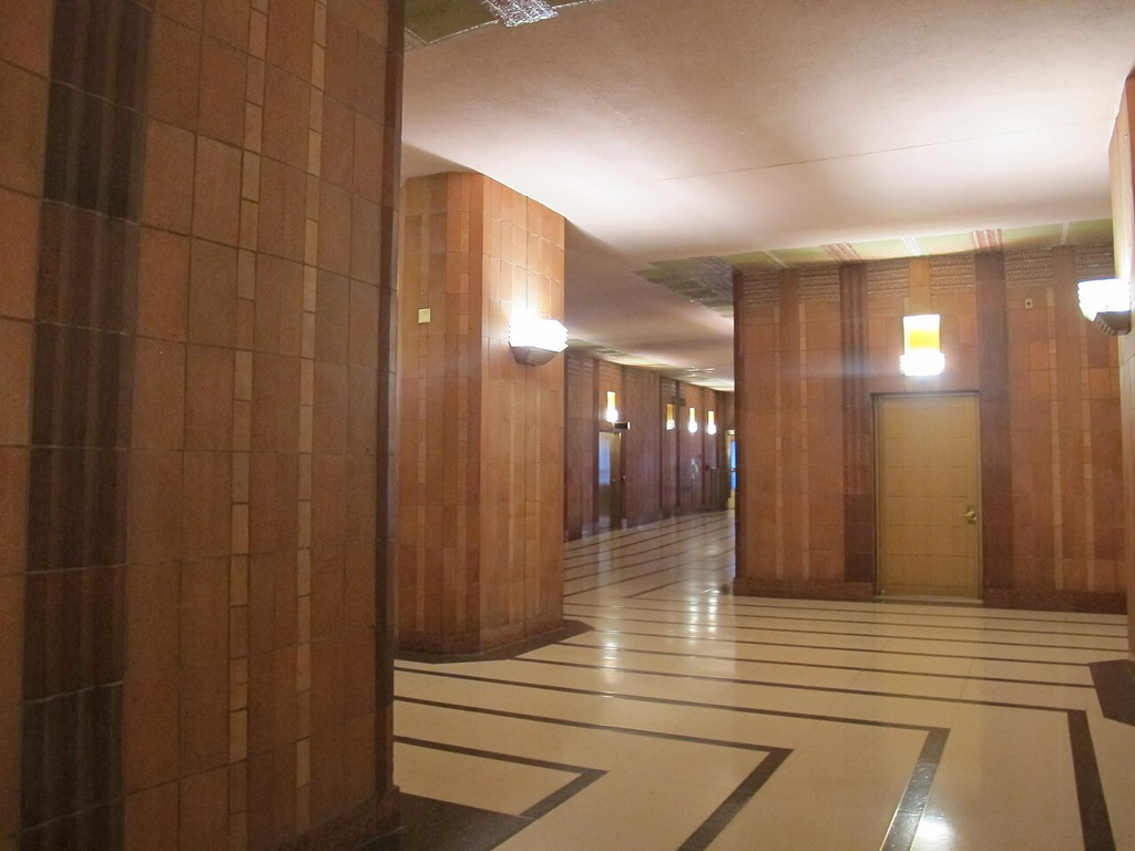
The building’s ground-level lobby is composed of a corridor from Sixth Avenue to Church Street.[14][16] Both ends of the lobby are approached by entrance vestibules with two bronze revolving doors flanked by two bronze hinged doors. The Sixth Avenue side contains an alcove in its vestibule, which leads to an auditorium.[16] Three elevator-lobby corridors branch off from the main corridor at a 90-degree angle: the two corridors on the north side of the lobby each have a bank of elevators, while the corridor on the south side leads to a bank of four elevators.[17] The Church Street side of the lobby is supported by a series of piers along the center of the corridor, and contains two perpendicular bends, giving the lobby an “S” shape.[16] An elevator bank with two elevators is located on the southern wall of the lobby near the Church Street entrance.[17]
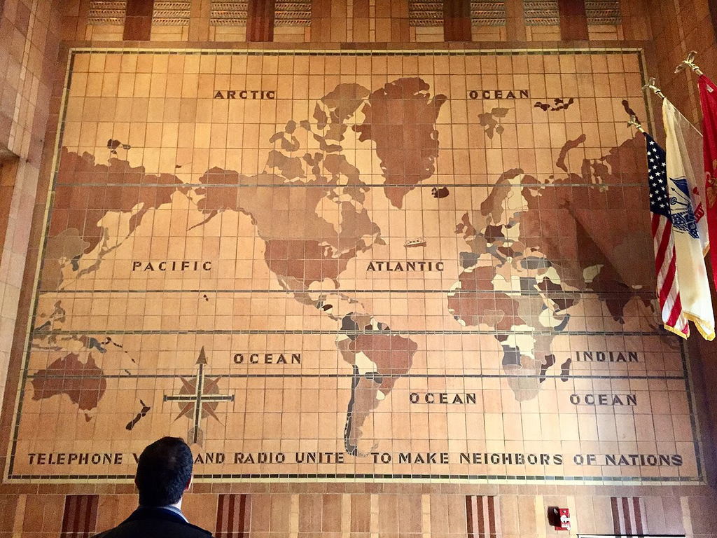
A white terrazzo floor with gray stripes extends through much of the lobby. The walls contain pink marble at their bottoms, above which are vertical ceramic tiles separated by red-tile pilasters.[16] The ceiling has a surface of mauve stucco.[18] The lobby also contains features such as bronze ventilation louvers and indirect-lighting fixtures.[16] Minor alterations have been made in the lobby over the years. On the Church Street side, the elevator bank used to contain two additional openings; throughout the lobby, signs and lighting have also been changed.[18] The lobby also contains an allegorical mosaic designed by Hildreth Meière, who also designed the interior of 1 Wall Street.[1][19][14][20] On the southern wall of the Sixth Avenue section is a tiled map of the world, measuring 16 by 23 feet (4.9 by 7.0 m).[16] The map contains the caption “Telephone Wires and Radio Unite to Make Neighbors of Nations”.[14][21][20]
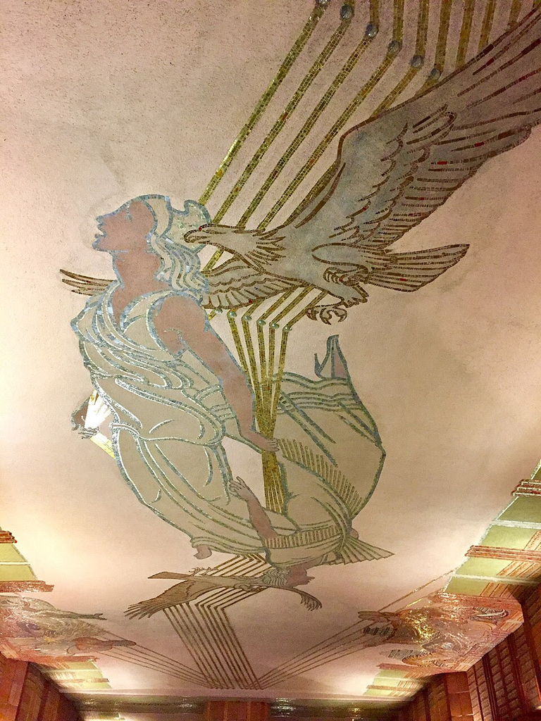
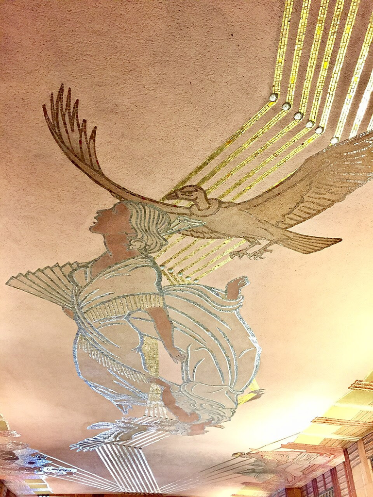
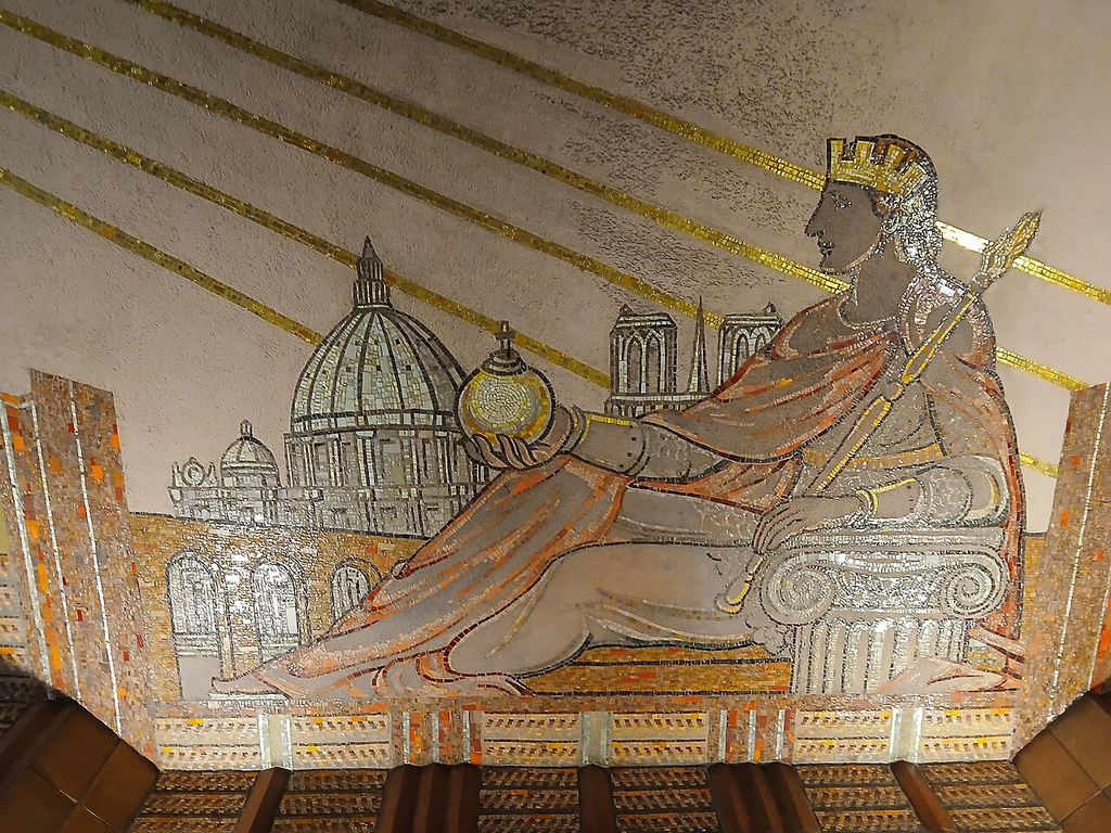
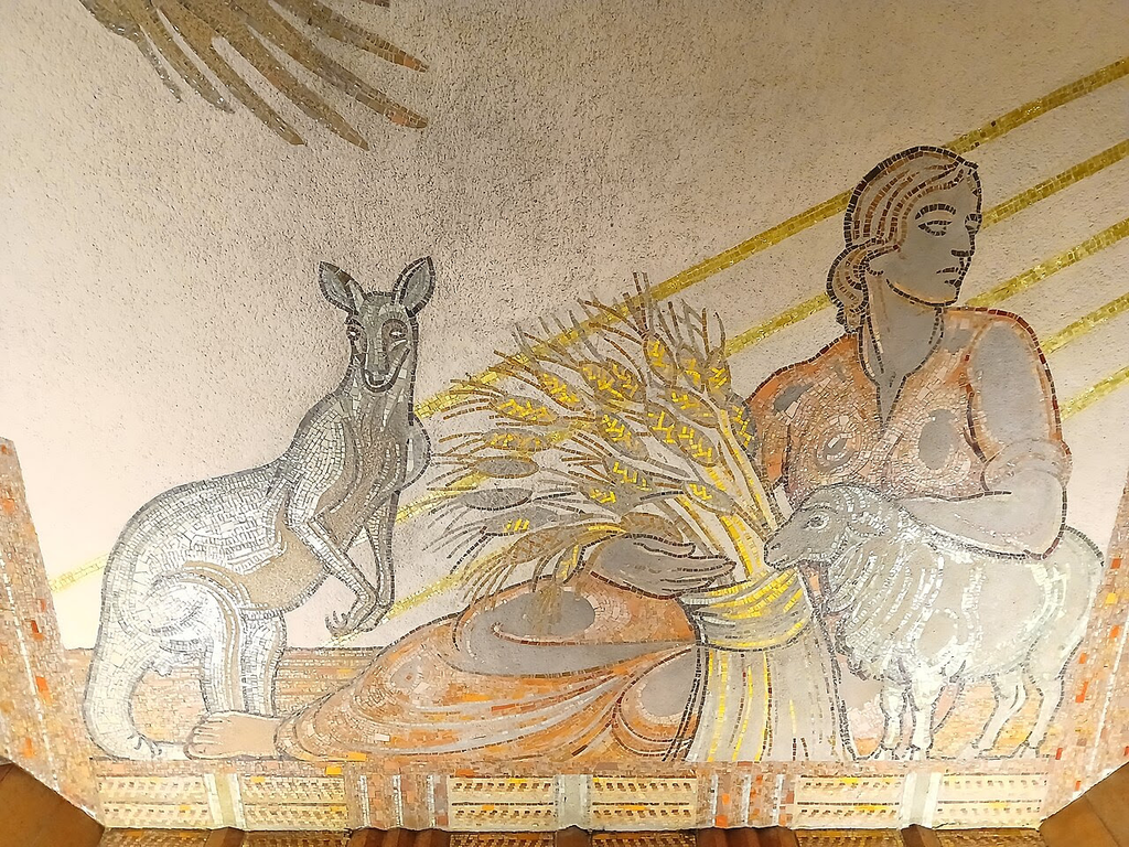
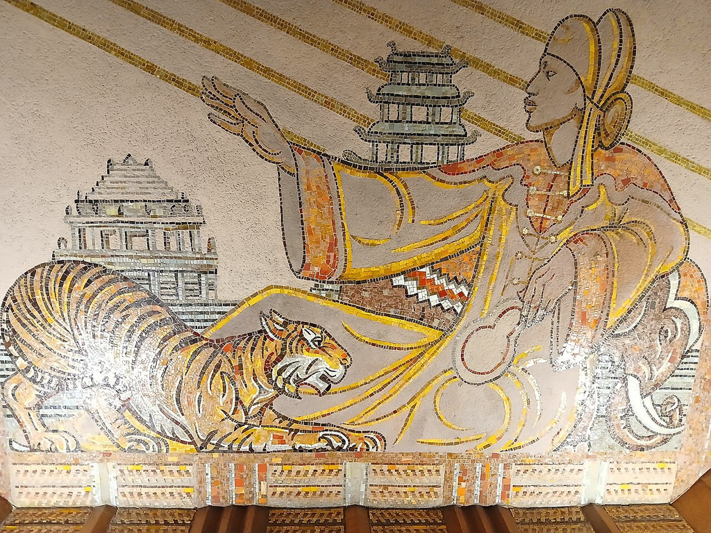
The ceiling mosaic contains allegorical representations of Asia, Europe, Australia, and Africa, connected by stylized telephone lines radiating from two female messengers in the center of the ceiling.[14][18][20] Asia is depicted as an empress with an elephant and tiger beside her, with a pagoda in the background. The representation of Europe wears a crown and holds a spear and orb while leaning on an Ionic-style capital; there is a Roman aqueduct, St. Peter’s Basilica, and Notre-Dame de Paris in the background. The representation of Australia is shown holding a sheaf of wheat, beside a sheep and a kangaroo. An Egyptian queen, depicting Africa, is shown holding a fan, with two lions and the Egyptian pyramids behind her.[18] The messengers in the center are flanked by an eagle and a condor, representing North and South America.[14][18] As a cost-cutting measure during the Depression, the ceiling mosaics were executed in a silhouette mosaic style, in which the outlines and details are made of traditional mosaic tile, and the interior areas are filled in with colored plaster. Meière had originally planned to decorate the ceiling with images of female telephone operators, but AT&T rejected those plans.[14] One of the female messengers in the center of the ceiling is wearing a stiletto heel, which may be a reference to Meière’s original design.[22]
The restored lobby with its long lined flooring
The Eagle Mosaic
The Condor Mosaic
Europe is symbolized by Notre Dame and the Vatican Dome
Australia is symbolized by Sheep and Kangaroos
Asia is symbolized by Pagodas, Elephants and TIgers
TELEPHONE CONNECTIONS THRU THE WORLD WERE MADE FROM THIS BUILDING
THE ANNUAL TRIBA EVENT IS COMING UP….STAY TUNED FOR REGISTRATION INFO.
PHOTO OF THE DAY
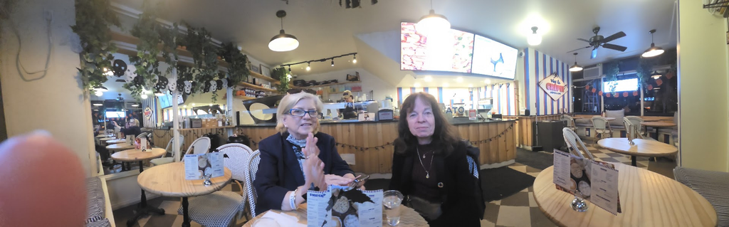
A crepe Snack at Vive Le Crepe 70th Street and Lexington Ave. A perfect spot to share with Faith and Ingrid
CREDIT
Wikipedia Judith Berdy
All image are copyrighted (c) Roosevelt Island Historical Society unless otherwise indicated THIS PUBLICATION FUNDED BY DISCRETIONARY FUNDS FROM CITY COUNCIL MEMBER JULIE MENIN & ROOSEVELT ISLAND OPERATING CORPORATION PUBLIC PURPOSE FUNDS.
Ghostly Remnants of the Nation’s First Graving Dock in Brooklyn
If you know where to look, you’ll find traces of a lost ship repair site in Red Hook.
Weekend, October17-18, 2026
Untapped New York
Issue # 1767
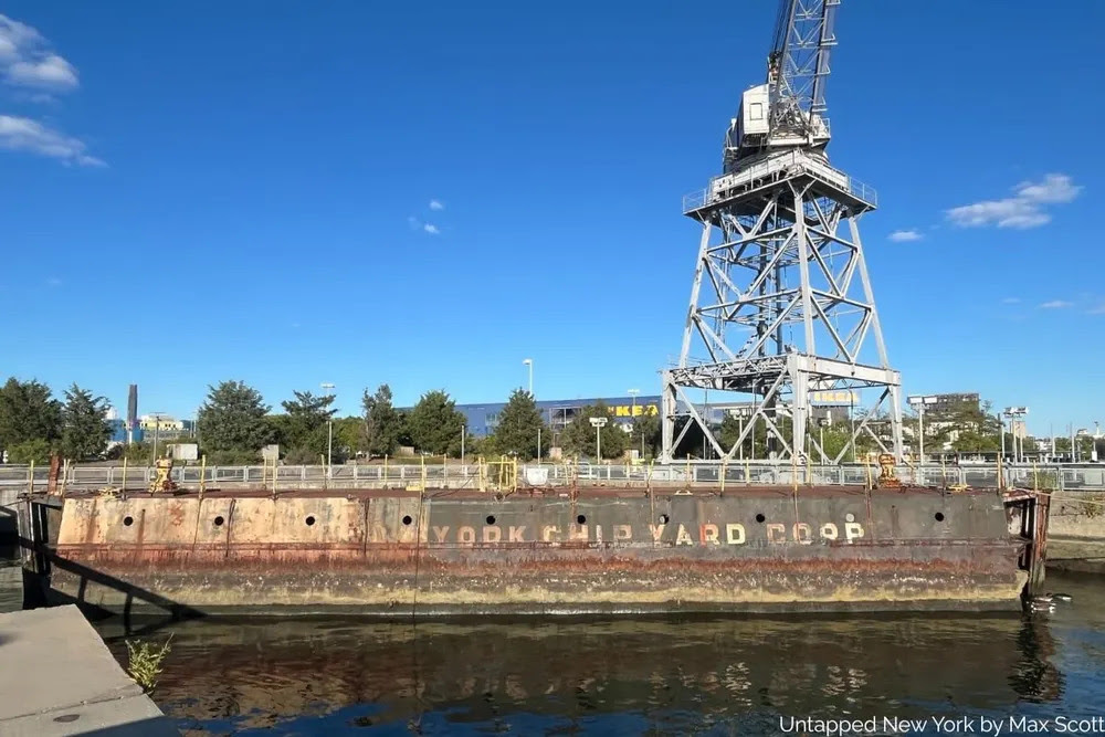
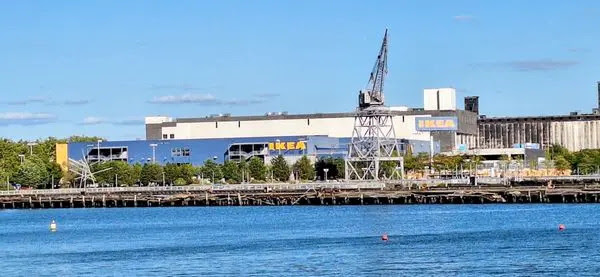
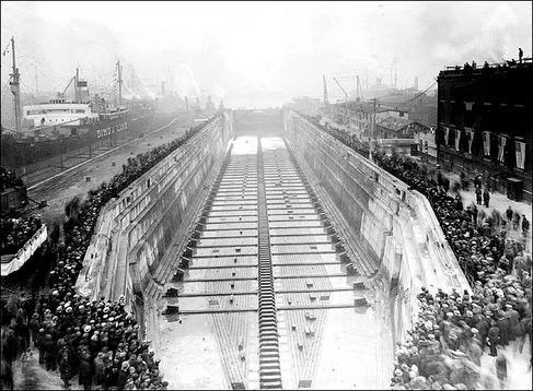
Red Hook’s IKEA is one of the neighborhood’s local landmarks. The store’s giant blue and yellow letters are visible for blocks around, and its free ferry service provides a vital link to Wall Street. But did you know that beneath IKEA’s parking lot, and still outlined in cobblestones that trace its former edges, lies the first graving dock in the United States?
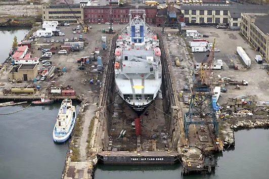
A graving dock is a type of dry dock where ships go for repairs, without having to be hauled onto land. These docks function like giant bathtubs; ships maneuver in, the gates are closed and the water is drained, leaving the ship exposed to the air and easily accessible for exterior repairs. New York City still has a working dry dock in the Brooklyn Navy Yard, but the Erie Basin dry dock in Red Hook was the city’s, and the country’s, first.
In 1864, William Beard—for whom Red Hook’s Beard Street is named—bought land along the Red Hook waterfront and built the Erie Basin. This was one of the first European-style, artificially-enclosed harbors in the city. The Erie Basin was originally built to capitalize on the storage and shipment of grain that flowed into New York from the Erie Canal.
The canal opened in 1825 and transformed the New York City into the nation’s most important port. Along with building dozens of grain warehouses, Beard also invested in the construction of two graving docks. These opened in 1866 and were in use for almost 150 years.
Soon after its construction, William Beard sold the graving docks to the Robins family, who operated it as the Robins Dry Dock and Repair Company for the rest of the 19th century. In 1916, the docks were sold to William Todd, an employee at the Robins docks who ended up forming a small shipbuilding empire as demand for shipyards and repair docks spiked during the First and Second World Wars.
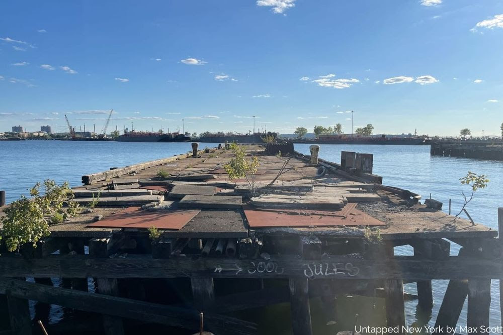
Abandoned pier looking toward the Erie Basin
The World Wars were the high-water mark of the shipbuilding and repair industry in New York, and nowhere was that felt more strongly than in Red Hook’s Erie Basin. In a 1920 Port of New York Annual report on the state of New York’s waterfront industry, the Todd Shipyards are described as being places of intense industry and round-the-clock work during World War I:
“No night nor day was known there, the twenty-four hours passed being met by the twenty-four coming with large forces of employees. Some great work was done there, such as lengthening some steamers and rebuilding others which were war damaged.”
After the end of World War II, Todd Shipyards continued to operate its graving dock on the Red Hook waterfront, but a changing local economy and new marine technologies meant that by the 1980s, business was drying up. Todd Shipyards closed its Red Hook docks in 1986. The docks were then sold to another owner, who leased it to different operators. All operations at the docks and adjacent piers finally ceased in 2005.
In 2006, IKEA proposed a flagship store on the site of the derelict Todd Shipyards. The plan included demolition of the piers and buildings adjacent to the old graving dock, replacing them with IKEA, and filling in the graving dock for a large surface parking lot. Despite attempts from the Municipal Arts Society, local preservationists, and even the comptroller to preserve the Civil War-era docks, the plan was approved and construction started in 2007. By 2008, the graving dock was filled in and paved over with a parking lot.
As a small gesture to the history of the site, the outline of the edges of the graving dock were preserved by a line of cobblestones that, when viewed from above, make the shape of a ship.
Input caption text here. Use the block’s Settings tab to change the caption position and set other styles.
About (from ATLAS OBSCURA)
Buried under the vast 1400-space parking lot of Ikea, a major fixture of waterfront industry was lost after 120 years of continuous operation. The Red Hook Graving Dock employed 20,000 workers in its heyday and was one of the few places in the New York Harbor where the biggest ships could be repaired.
A graving dock, named for its coffin-like shape, allows boats to float in it while draining the water, exposing the hull for repair. 540 feet long when it was constructed in 1886, the Red Hook Graving Dock was extended twice in coming decades to its final length of 730 feet, earning it the designation by Scientific American as the longest dry dock in the country and possibly the world. It took 15 million gallons of water to fill it up.
In the mid-1880s, Red Hook was a natural site for such a massive maritime facility. At the junction of the Erie Canal and the Atlantic ocean, Red Hook could provide shipping traffic with repair services and a population to attend to the laborious tasks.
The terms under which Ikea got permission to pave over the dock met with great contestation from community groups and preservationists. The Swedish big-box retailer bought the property for 30 million dollars in 2005 and ignored alternative plans to save the graving docks from destruction. At the time of purchase, the dock was the only one big enough in New York to service some of the city’s own sanitation and sludge vessels. The paving over of the dock met with additional criticism in 2008 when the city released a report that New York’s maritime industry needed up to seven more graving docks to meet existing demand for big-boat repair services.
THE ANNUAL TRIBA EVENT IS COMING UP….STAY TUNED FOR REGISTRATION INFO.
PHOTO OF THE DAY
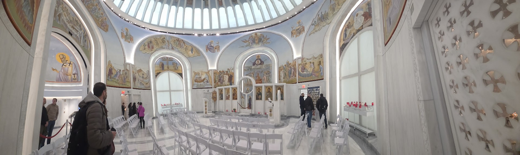
St Nichola National Shrine Liberty Streert Designed by Santiago Calatrava
CREDIT
Untapped New York Atlas Obscura
All image are copyrighted (c) Roosevelt Island Historical Society unless otherwise indicated THIS PUBLICATION FUNDED BY DISCRETIONARY FUNDS FROM CITY COUNCIL MEMBER JULIE MENIN & ROOSEVELT ISLAND OPERATING CORPORATION PUBLIC PURPOSE FUNDS.
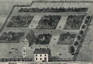
In 1748, twenty-year-old Swiss-born Jacob Sperry arrived in the city of New York from Zurich. Trained as a physician, he abandoned medicine as his real passion was horticulture. In 1771 he bought a plot of pastureland and turned it into the city’s first botanical garden, growing flowers, hothouse plants, and fruit. Despite its distant location on the city’s northern outskirts, his gardens became a (romantic) destination for weekend walkers and a hub for buying floral arrangements.
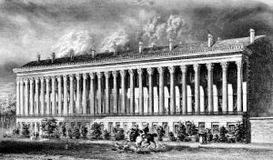
Sperry cultivated the land until 1803, when he sold the gardens to John Jacob Astor (1763-1848), a German-speaking immigrant from Walldorf, near Heidelberg, who had turned his attention from the profitable fur trade to real estate. The latter leased the property to Joseph Delacroix, a French-born confectioner and entrepreneur who was expanding his pleasure garden business. He transformed the estate into Vauxhall Gardens, an entertainment resort modeled after the eponymous park in London. Once Delacroix’s lease expired in 1826, Astor commissioned the construction of a passage in honor of Marquis de Lafayette, a former French volunteer in the Continental Army who had served as a member of General George Washington’s inner circle. In 1825, the Revolutionary War hero toured New York State on a triumphant return, visiting cities like Buffalo, Lockport, and Rochester. He inspired the naming of streets and parks across the former colonies, including the town of LaFayette, NY. Lafayette Place (now Lafayette Street) sliced through Vauxhall Gardens and would inaugurate another monument of gratitude to the Marquis: the completion of La Grange Terrace, a row of nine Greek Revival townhouses named after Château de la Grange-Bléneau, Lafayette’s country estate at Courpalay, thirty miles southeast of Paris (which he considered his own version of Mount Vernon). Colonnade Row Construction of La Grange Terrace in the city of New York began in 1831. Finished two years later, the properties offered luxury amenities such as running hot and cold water, central heating, and bathrooms. Later referred to as “Colonnade Row,” Connecticut-born Seth Geer was the project’s builder and developer. But who inspired its design?
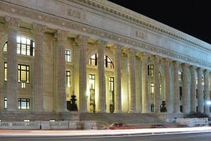
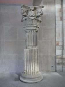
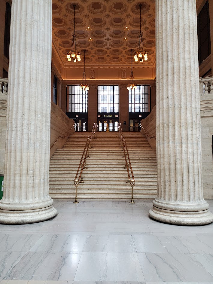
The use of marble in French and British monument building served to project civic pride and imperial power. The controversial removal of the Parthenon sculptures (Elgin Marbles) in 1816 intensified the focus on Greek antiquity. Robert Smirke’s design of the British Museum in Bloomsbury featured forty-four Ionic columns. In the 1820s, John Nash revolutionized London’s cityscape by designing neoclassical terraces encircling Regent’s Park. A defining element of these residential structures was the extensive use of marble colonnades, blending multiple townhouses behind a single facade. In 1829, Ithiel Town and Alexander Jackson Davis formed an architectural partnership in Manhattan. Lasting until 1835, the firm became synonymous with the Greek Revival movement in the city. In 1829/30 Town made a study trip to Europe. Visiting London, Nash’s classical style inspired him. He took the colonnade concept home with the ambition of bringing similar grandeur to New York’s streetscape. It became central to his designs in public and private commissions. La Grange Terrace was a prime example of his work. Its residences were fronted with a two-story-high marble colonnade, consisting of twenty-seven columns inspired by the Choragic Monument of Lysicrates in Athens (considered the first Corinthian columns in antiquity).
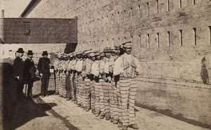
Marble porches extended directly to the sidewalk. Tall French mahogany doors on silver hinges opened onto balconies connected by wrought iron railings. Lafayette Place was an exclusive cobblestoned cul-de-sac, an elite enclave. In 1833, the New York Evening Post lauded the apartments as “unequalled by any private dwellings in the country.” The twenty-six room residences were among the city’s most desirable addresses, occupied by John Jacob Astor II, Cornelius Vanderbilt, the Gardiner family (when in 1844 President John Tyler married Julia Gardiner, the couple hosted their post-wedding breakfast at the property), and Warren Delano, Franklin Roosevelt’s grandfather. Sing Sing Marble Where did all the stone come from? Westchester marble or “Snowflake” for its crystalline look, was a dolostone found in the geologic formations of southern New York. After the discovery of large reserves in Tuckahoe, Scottish-born stonecutter Alexander Masteron of Broome Street, Manhattan, set up a mining company and by 1812 quarrying had begun. In 1824, his firm provided the white marble to build New York’s branch of the Bank of the United States on Wall Street (the façade of this Greek Revival structure was reconstructed a century later at the Metropolitan Museum of Art, fronting its American Wing). In 1825, New York State authorities decided to build a fifth prison in the region. Mount Pleasant State Prison opened in 1828 at its location in Sing Sing (now Ossining, in Westchester County). The name of the village was linked to its original inhabitants, the Indigenous Sintsink tribe. The phrase “sin sinck” translates from its Algonquian language to “stone upon stone.” The site was chosen for the rich deposits of local white stone, soon labeled “Sing Sing marble.” By May 1825, hundred chained men had been relocated from Auburn Prison to temporary on-site barracks there. Under the ruthless command of Captain Elam Lynds, they were sent out to quarry and cut stones. Sing Sing’s prisoners built a cell block that would hold eight hundred inmates. By November 1828, the project was completed. Two years after finishing the “Castle on the Hudson,” convicts mined enough marble to construct a prison hospital and chapel. Abundant building materials reduced cost and drove rules of hard labor. The “old hellhole” was notorious for its ferocious regime installed by Lynds.
When mining, men worked in groups but were not allowed to communicate with each other; they spent the night confined to solitary cells. The implementation of a rigid “lockstep” system further controlled the behavior of inmates. Violent punishments were common. Prisoner-quarried Sing Sing marble was utilized for the building of historic residences throughout the Ossining region and shipped down the Hudson to construct some of the city’s landmarks, including St Patrick’s Cathedral, the Washington Square Park Arch, and the Metropolitan Life Insurance Tower. Manhattan was covered in Sing Sing marble. The builders of Colonnade Row also used the material. For John Jacob Astor, America’s first multi-millionaire, it was a lucrative deal that financed its construction.
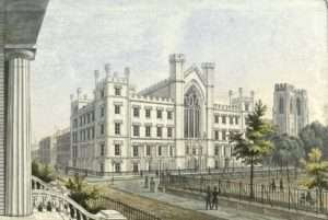
In 1834, the building began of the first section of New York University (NYU, founded in 1831), a Gothic Revival structure on the east side of Washington Square designed by Alexander Jackson Davis and Ithiel Town. In the process, contractors bypassed local stonemasons to buy cheap Sing Sing marble. Workers and trade guilds resisted such unfair competition and organized rallies that turned violent. To restore public order, Mayor Cornelius Van Wyck Lawrence called out the National Guard. The Stone Cutters’ Riot was one of the city of New York’s first mass labor revolt. Paris & London In January 1847 Charles Dickens visited Victor Hugo in Paris. Despite mutual admiration between Europe’s two greatest novelists, it was a frustrating meeting because of language barriers. If anything, it was a symbolic encounter. For both writers, architecture played a crucial role in their novels. The authors shared a contempt for neoclassical colonnades. Victor Hugo depicted Paris as a site of social unrest and human suffering. In novels like Les Misérables, the city streets tell the story of a restless society on the brink of revolutionary change. In 1825, the author penned several notes in which he lamented the destruction of medieval architecture in Paris. Frustrated by dominating neoclassical Revival trends, he cried out: “Oh! Qui me délivrera des colonnades?” (Who will deliver me from colonnades?). These reflections would feed into a broader campaign in which he declared Guerre aux démolisseurs! (War on the Demolishers, 1832) and the creation of his novel Notre-Dame de Paris (1831). Charles Dickens viewed London’s back streets, brick alleys, and industrial sites as physical manifestations of human misery. In novels like Bleak House, he mapped the capital’s socio-economic and moral decay. The author often referred to colonnades in his novels and travelogues when criticizing contemporary architecture or illustrating social environments. Dickens did not view them as symbols of “timeless” beauty but looked at them from a socio-critical and atmospheric perspective. He contrasted pristine ancient Greek design with London’s sooty black bricks. Classical architecture was not suited to the bleak reality of a northern industrial society. Colonnades were out of place in the damp darkness of a wind-swept environment. Modern architects had lost the plot. When Dickens toured America in 1842, New York treated him like a royal. To accommodate his status, his guests hosted him at Colonnade Row. He shared the prestige of staying at this address with other legendary authors of the era, including Washington Irving, Edgar Allan Poe, and William Makepeace Thackeray. It must have been an unsettling experience for him to be feted in a marble-fronted Greek Revival townhouse, a style of building he had attacked repeatedly in his work. Passion for Colonnades Increasingly, European critics attacked the Revival style as a pastiche without connection to contemporary society. The copying of historical forms showed lack of initiative. It was a sign of cultural exhaustion. Instead of creating their own style, architects lived in the past, ignoring new building materials, and neglecting the advances in engineering. Innovation was restricted to utility structures, railway stations, prisons, and exhibition halls. The call for “modernism” came from European critics. The United States remained obsessed with colonnades.
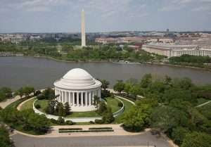
Thomas Jefferson embodied the principles of neoclassicism. Appointed as a Minister Plenipotentiary to the Court of Versailles in May 1784, he had sailed from Boston aboard the merchant brig Ceres to join Benjamin Franklin and John Adams in Paris and would eventually become the senior Minister in France. The once provincial Virginian returned in November 1789 as a cosmopolitan individual with dreams of turning America into a thriving democracy that would rival Europe in art and science. For Jefferson, architecture was the incarnation of political philosophy. The nation’s official buildings should safeguard the virtues of liberty and self-governance. Rejecting British colonial building as a reminder of Royal tyranny and religious dogmatism, he championed neoclassicism as the style to embody the Republic’s democratic ambitions. His ideas shaped the lay-out of Virginia State Capitol and the design of his Monticello home. For Virginia University, he designed an “academical village” around a central lawn framed by pavilions and colonnades (Pavilion VII, the oldest building in the village, is home of the University’s “Colonnade Club”). The concept of a national neoclassical architecture also drove the builders and developers of the capital. They filled Washington with rows of white columns that symbolized the balance and vigor associated with ancient governance. Courts, libraries, museums, and banks also adopted columned façades to impress monumental significance. No colonnade, no relevance. Form Follows Function In 1851, Israel Underhill bought a couple of residencies at Colonnade Row and turned them into The Oriental, a “family hotel” for wealthy New Yorkers who chose an elite lifestyle without having to employ servants. By the 1860s, Lafayette Place began to lose its appeal as commercial ventures on Broadway encroached upon this once select residential cul-de-sac. Regional demographics shifted as its occupants moved uptown. Murray Hill and its attractive Italianate brownstone row houses became the new prestige neighborhood. In 1875, the five southernmost houses were turned into The Colonnade Hotel with an entrance on Broadway. In 1902/3, the hotel was demolished to make way for a warehouse owned by Wanamaker’s department store, leaving only the four houses that are still there today (protected since 1965 with a designation by the Landmarks Preservation Commission). The Oriental lasted as a boarding house until 1915, but the Row’s demise had been set in motion. During the 1890s, Louis Sullivan and other pioneers of modern architecture began condemning the replication of ancient Greek and Roman models in contemporary building. They launched the slogan “form ever follows function,” a design principle whereby the shape and structure of a building must be determined by its intended use. Arguing that outdated historical costumes of European Revivalism stifled the ambition of creating an American stylistic identity, modernists abandoned smooth marble for concrete and steel. They crushed the colonnades.
THE ANNUAL TRIBA EVENT IS COMING UP….STAY TUNED FOR REGISTRATION INFO.
PHOTO OF THE DAY
Can you identify this staircase from a famous movie?
CREDIT
WIKIPEDIA JUDITH BERDY
All image are copyrighted (c) Roosevelt Island Historical Society unless otherwise indicated THIS PUBLICATION FUNDED BY DISCRETIONARY FUNDS FROM CITY COUNCIL MEMBER JULIE MENIN & ROOSEVELT ISLAND OPERATING CORPORATION PUBLIC PURPOSE FUNDS.
Sunday was the second Sunday that Gloria Herman and I explored Brooklyn. The best way to get to Trader Joe’s in Williamsburg is to drive. This store has indoor parking, a wonderful service and a gigantic store. After securing our groceries in the car, we drove to Greenpoint in search of a snack.
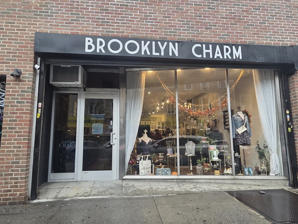
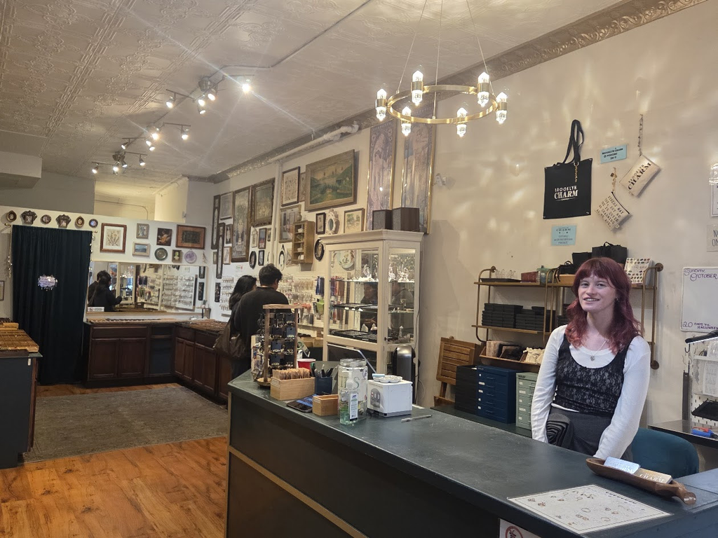
We parked in front of Brooklyn Charm at 616 Manhattan Avenue. This shop specializes in the latest necklace fad, small charms on necklaces and bracelets.
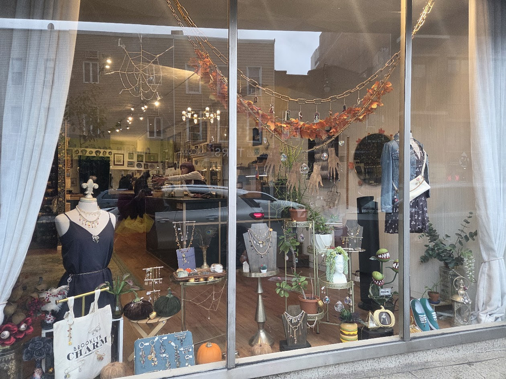
A lovely and unique window display drew out attention to visit inside.
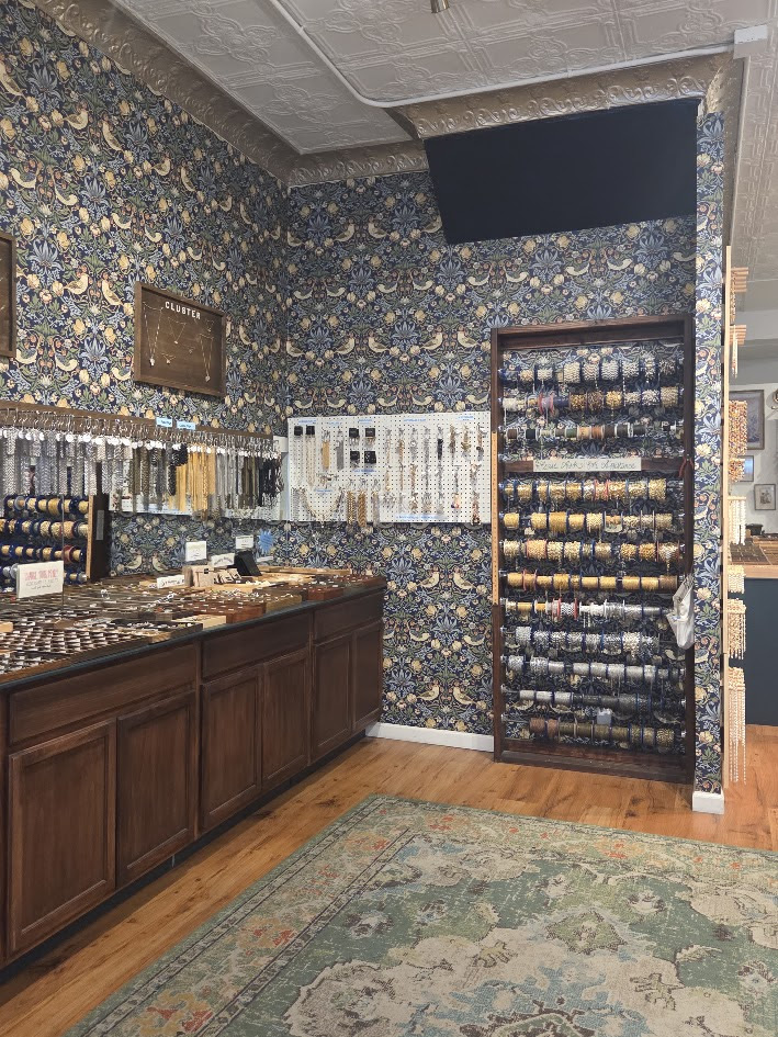
Dozens of chain styles and trays of all kinds of trimmings for your custom jewelry. the selection is vast and the store is enhanced WIlliam Morris design wallpaper.
The sales staff were friendly and we chatted about jewelry styles. We asked for a suggestion for a snack and the women suggested the pirogi restaurant down the street.
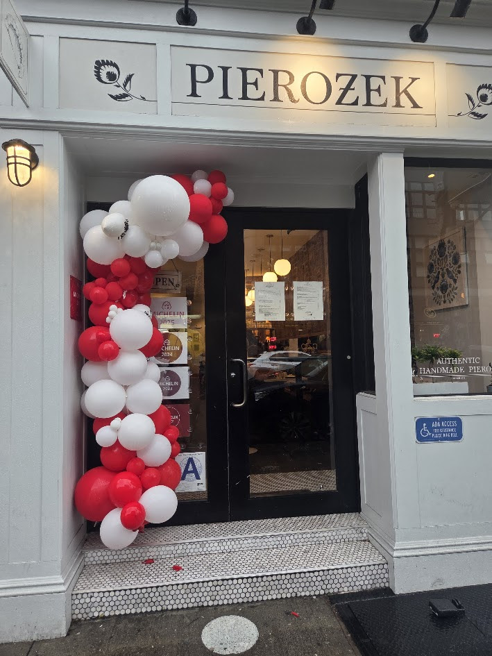
We found Pierozek a few doors down at 592 Manhattan Avenue. This bright restaurant with balloons outside was an immediate welcome.
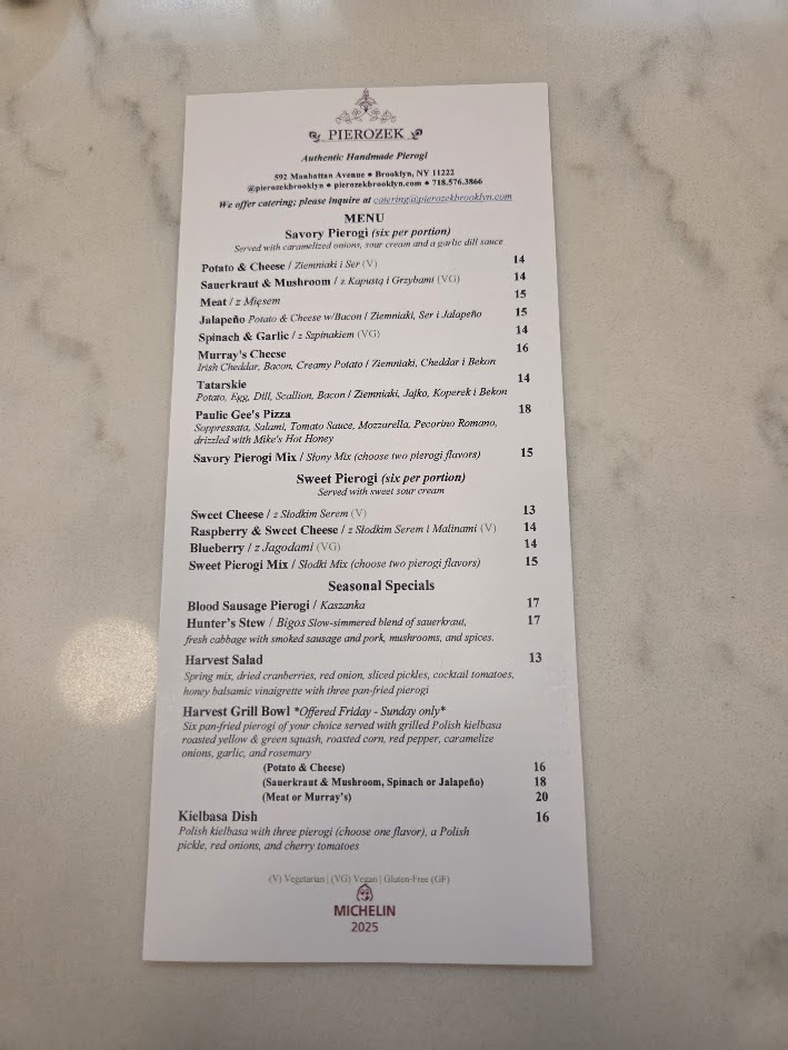
The menu is short and iots of combinations of pierogi are available.
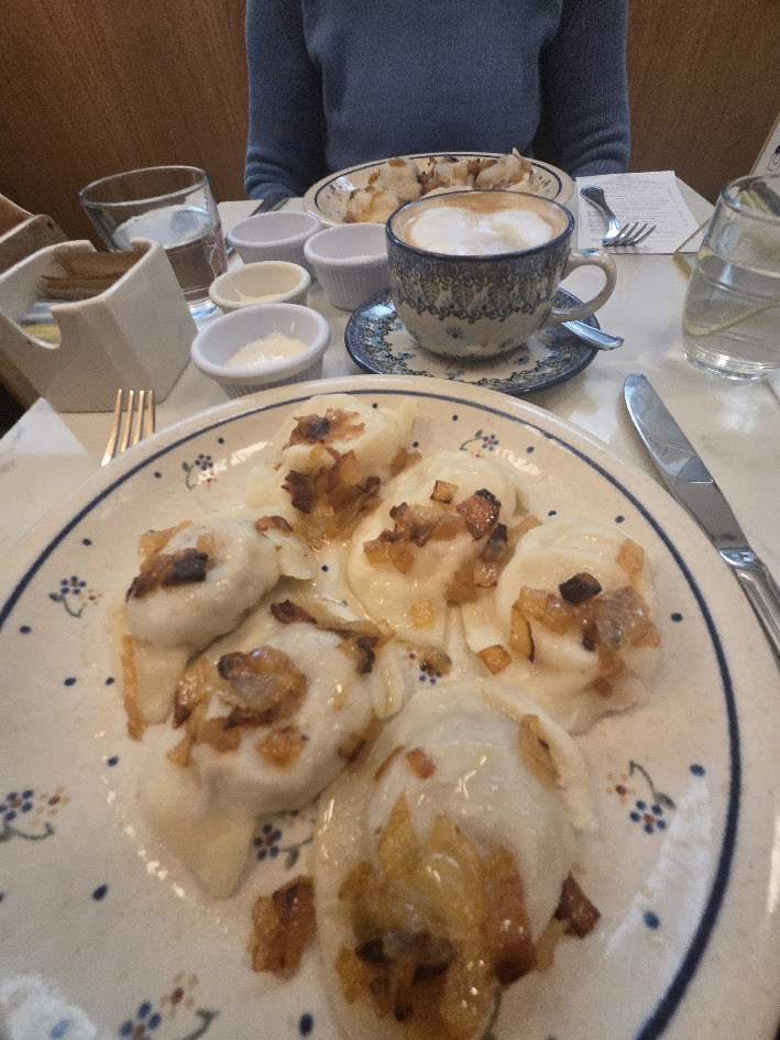
I chose a combination of meat and cheese pierogi. The come with onions and sour cream. Piping hot, soft and delicious they were a great treat.
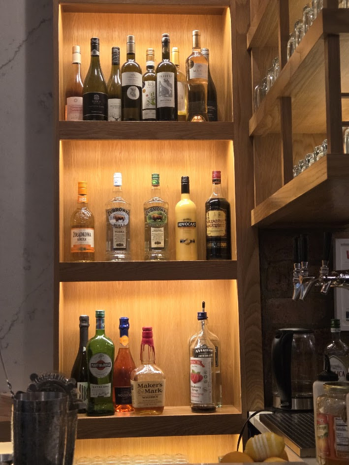
Liquor is served or delicious cappucino, for this cold and wet day. The wait staff were friendly and most of the other diners were Polish and enjoying this restaurant.
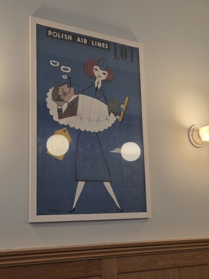
There are Pierogi shaped pillows for the true afficionado. Also, a cute poster from LOT Polish Airlines with a passger wrapped in a pierogi.
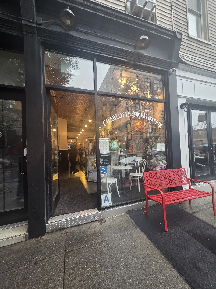
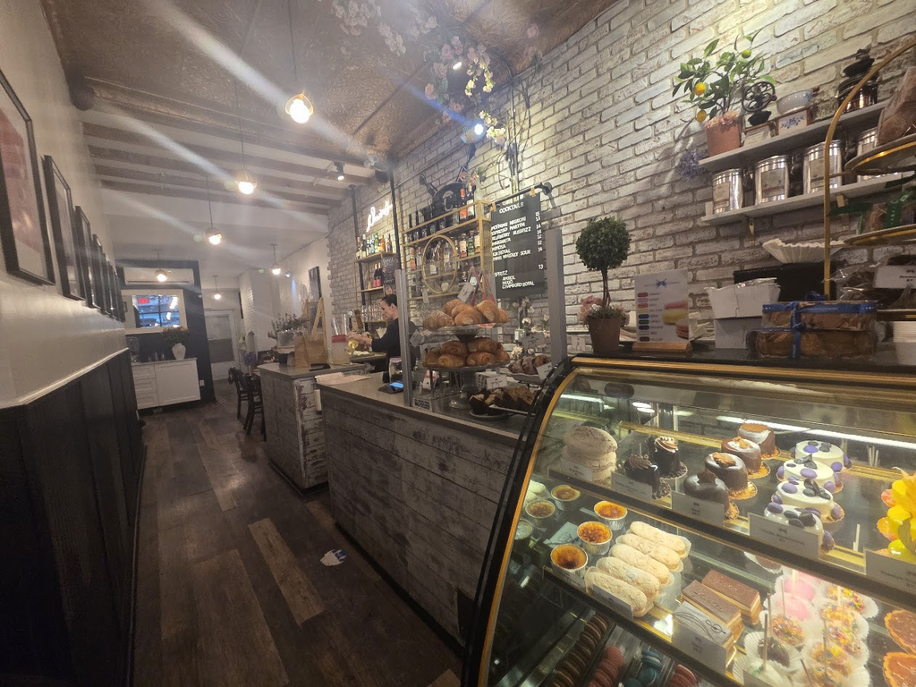
Next door is Charlotte Pattisserie, which was so tempting. After pierogi meal, we looked inside at the cake display and decided to return aother day.
THE ANNUAL TRIBA EVENT IS COMING UP….STAY TUNED FOR REGISTRATION INFO.
PHOTO OF THE DAY
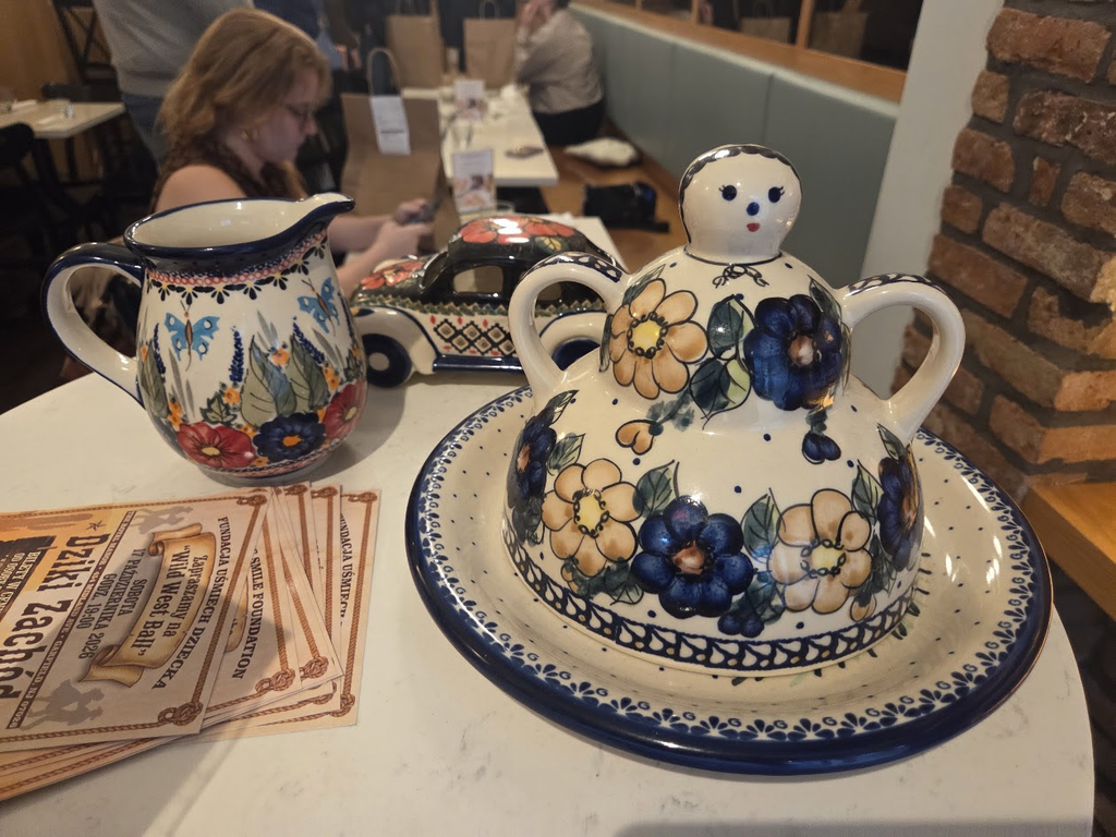
CHARMING POLISH POTTERY FOR SALE (?) AT PIEROZEK
CREDIT
WIKIPEDIA
JUDITH BERDY
All image are copyrighted (c) Roosevelt Island Historical Society unless otherwise indicated THIS PUBLICATION FUNDED BY DISCRETIONARY FUNDS FROM CITY COUNCIL MEMBER JULIE MENIN & ROOSEVELT ISLAND OPERATING CORPORATION PUBLIC PURPOSE FUNDS.
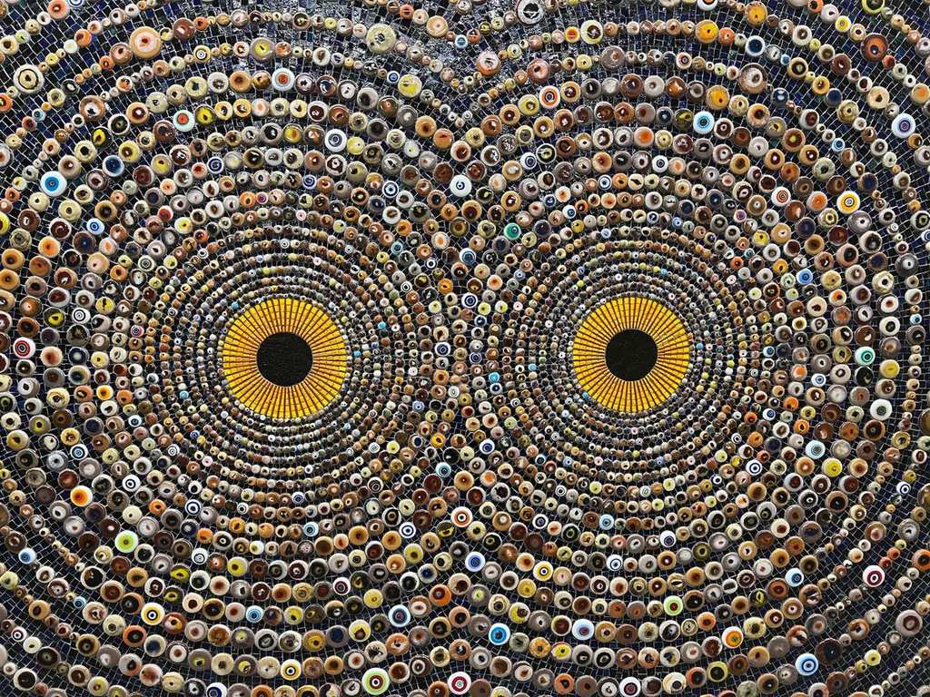
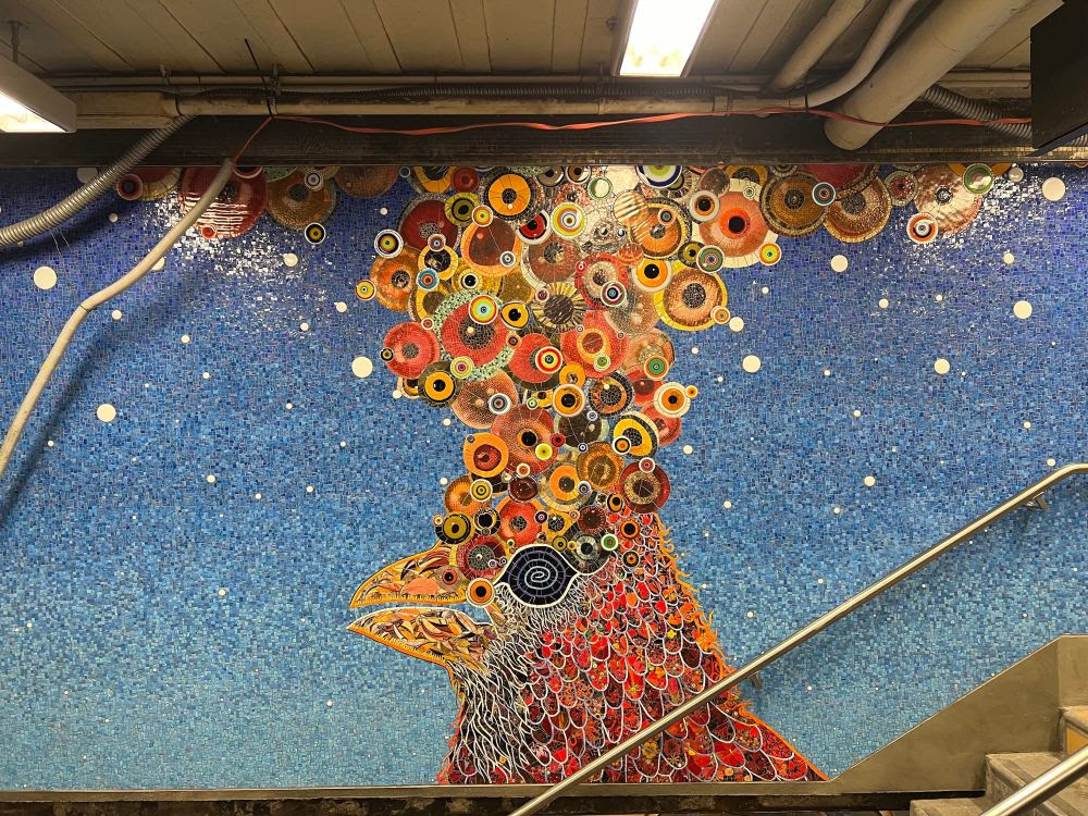
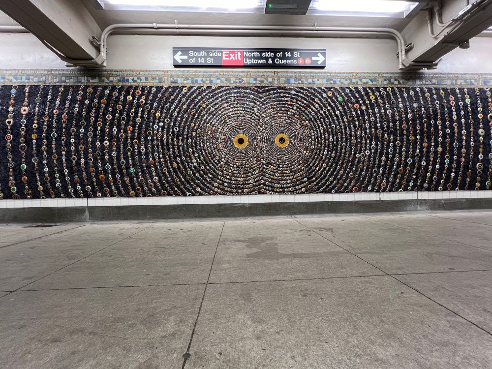
This particular mosaic detail resembles Tomaselli’s collage of Flaco the eagle owl. (image courtesy Fred Tomaselli)
In one of New York City’s transport hubs, riders are now watched by hundreds if not thousands of glass and ceramic eyes.
Earlier this year, artist Fred Tomaselli created “February 25, 2024,”acollage imagining a Sunday New York Times front page announcing the death of Flaco the eagle-owl. Tomaselli envisioned the beloved bird with hundreds of colorful spiraling eyes and a befitting headline: “New Yorkers Mourn Neighbor They Could All Look Up To.” In Tomaselli’s latest work, he again draws New Yorkers closer to the world of aves, this time reaching a wider audience with a massive mosaicinstallation that will last beyond his lifetime.
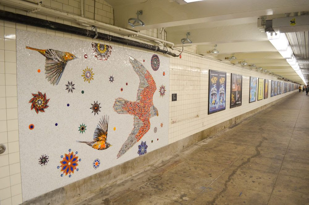
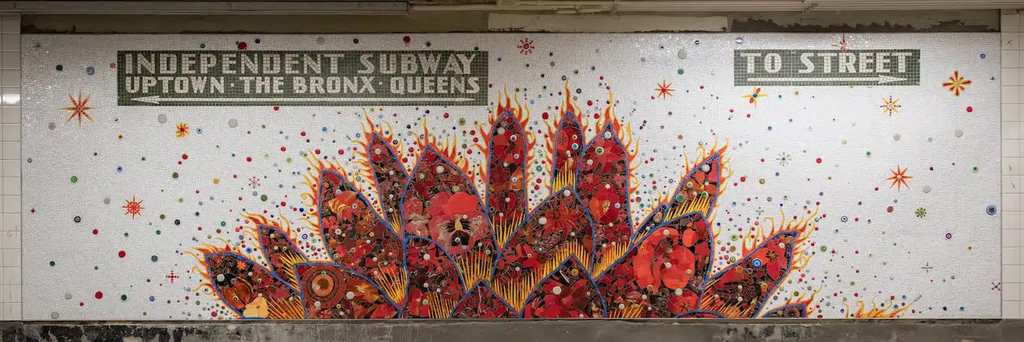
Fred Tomaselli’s mosaics along a subway transfer pathway at the 14th street subway station complex (photo by Isa Farfan/Hyperallergic)
New York City’s Metropolitan Transportation Authority (MTA) Arts and Design commissioned Tomaselli in 2022 to create a permanent 680-square-foot mosaic series in Manhattan’s 14th Street subway station, which is notorious for its avenue block-long pathways facilitating commuter transfers from one line to another.
The MTA inaugurated Wild Things (2024) on Monday, November 4, just before Election Day, after a three-week installation. During election season, Tomaselli sold his bird-inspired work, including “February 25, 2024” (2024), to benefit the Kamala Harris campaign.
Tomaselli took a clear position in this year’s presidential race and has used his New York Times collage series to annotate front-page world news in addition to selling his work to fundraise for sustainability initiatives. The artist said he often uses his practice to address “the chaos and the pathologies of the world,” but this work is different.
“There’s no overt politics,” Tomaselli told Hyperallergic, “other than this idea that art is worth making, nature is worth preserving, and the natural world is strange and amazing.”
Tomaselli said he wanted to bring the complexity of life above ground into the underground station. (image courtesy Fred Tomaselli)
Tomaselli said he had “hit a burnout phase” with his more political art at the time he began designing his everlasting public work and felt depressed by it. He said he wanted to make “something to escape into the out of this ugly moment that we’re living through.”
“I just wanted to dive head first into this idea of the strangeness of the eternal natural world, an increasingly imperiled world,” Tomaselli said. “I wanted to bring this strangeness of the complexity and oddness that lives above ground and put it underground.
For his first-ever mosaic and permanent public installation in Manhattan, Tomaselli translated his mixed-media painting technique into tile and glass fragments with the help of the German stained glass manufacturer Mayer of Munich.
“We kind of assembled it out of Frankenstein bits of my older work,” Tomaselli said. “We made a lot of eyes by taking circular sheets of glass, laying them on top of each other, and then putting them in a blast furnace to melt them together.” He did the same with ceramic.
One mosaic presents riders with a psychedelic representation of a set of eyes diffusing into thousands of tinier eyes, resembling Tomaselli’s Flaco collage. In another, mosaic birds fly next to a spate of aggressive advertisements.
One mosaic contains what appear to be hundreds or thousands of small eyes. (image courtesy Fred Tomaselli)
Tomaselli has lived off the L train, which passes through the station, for nearly 40 years. His studio is also located along the line and so was his son’s former school.
A personal project, Tomaselli said he felt “good” about the final product, but not without a twinge of melancholy.
“I know my son will probably be riding the L train long after I’m gone,” Tomaselli said. “When I finally saw it up there, I was like, ‘God, I’ve entered into the transit history of New York.’ Hundreds of thousands of people are going to pass by this every day, day in and day out, year after year, for 100 years, maybe more. ”
THE ANNUAL TRIBA EVENT IS COMING UP….STAY TUNED FOR REGISTRATION INFO.
PHOTO OF THE DAY
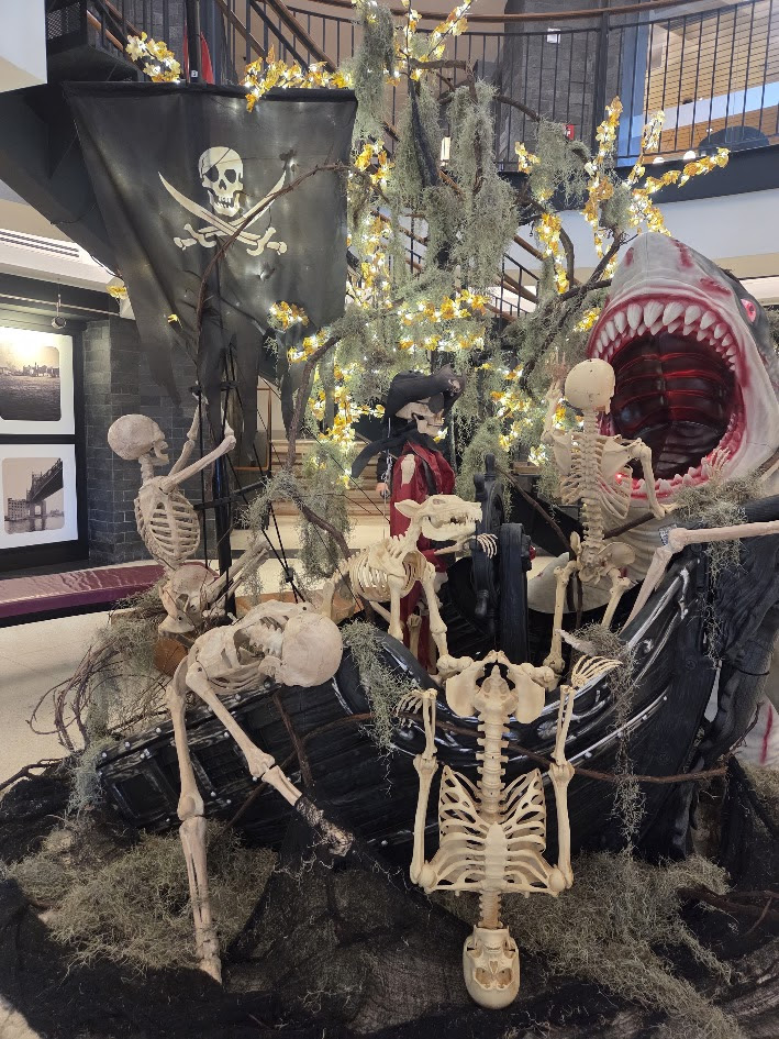
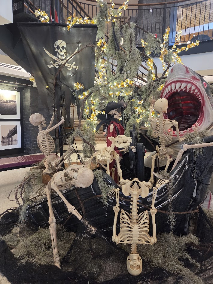
HALLOWEEN FUN RETURNS TO THE OCTAGON LOBBY
CREDIT
WIKIPEDIA JUDITH BERDY
All image are copyrighted (c) Roosevelt Island Historical Society unless otherwise indicated THIS PUBLICATION FUNDED BY DISCRETIONARY FUNDS FROM CITY COUNCIL MEMBER JULIE MENIN & ROOSEVELT ISLAND OPERATING CORPORATION PUBLIC PURPOSE FUNDS.
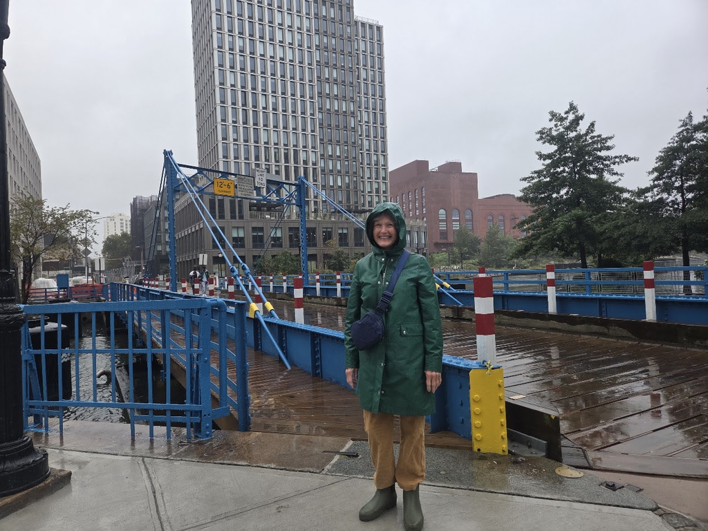
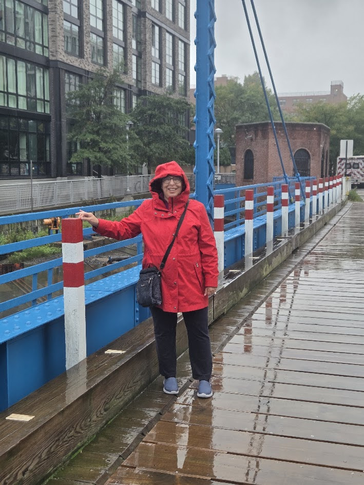
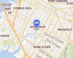
Last Sunday Gloria Herman and I ventured to see the newly reopened Carroll Street Bridge in Brooklyn. In the pouring rain the freshly restored bridge stood out in vibrant blue.
Whose idea was it to venture in this weather?
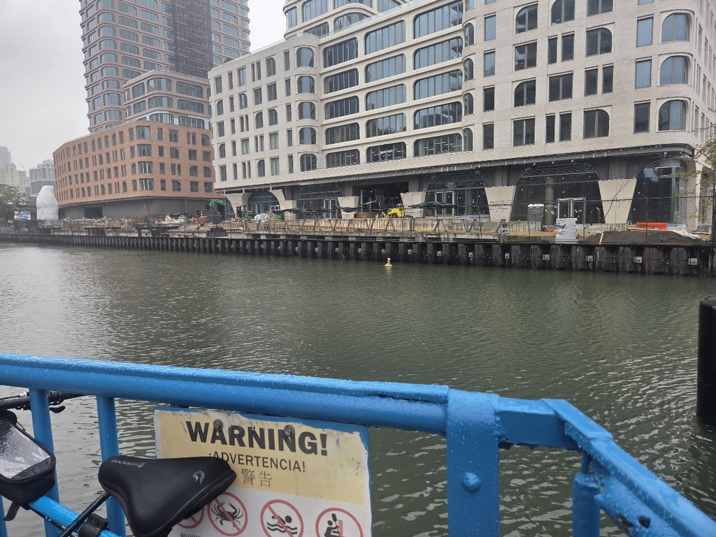
The Gownus Canal is now surrounded by high rise apartments, sort of what happened to the High Line. Views are being destroyed by construction projects, and over development.
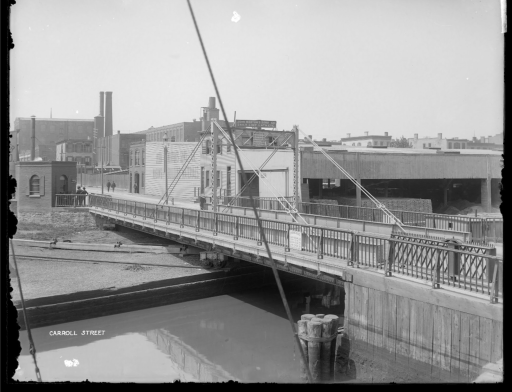
The original span
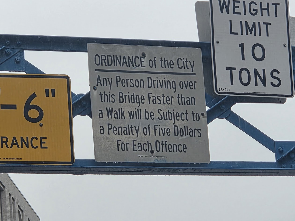
When was the last time the $5- fine was collected?
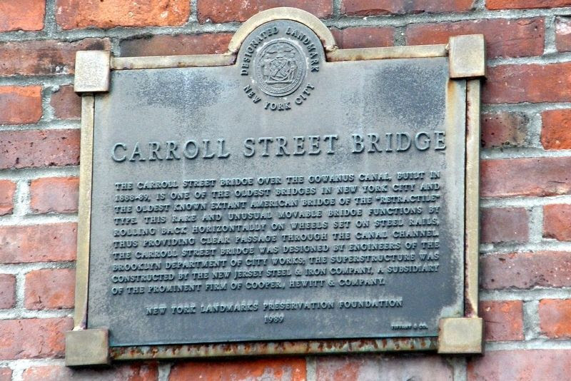
The plaque commemorating this NYC Landmark
The Bridgekkeepers House in in the background.
Fom Wikipedia
The Carroll Street Bridge is a retractable bridge in New York City, crossing the Gowanus Canal in Brooklyn. It carries a single wooden-decked lane and two sidewalks. Completed in 1889, it is operated by the New York City Department of Transportation. It was a vehicular and pedestrian bridge until closed for rehabilitation in 2021; after reopening in 2026, it has carried only pedestrians, bicycles, and emergency vehicles. It is the oldest of the four remaining retractable bridges in the United States and is an official city landmark.
Description
The Carroll Street Bridge is composed of a 107-foot-long (33 m) span supported by a pair of riveted steel plate girders.[2]: 5 The span is 17.5 feet (5.3 meters) wide and contains one lane, formerly used for eastbound vehicular traffic, and one walkway to either side. It carries the street of the same name within the neighborhood of Gowanus, Brooklyn. The posted restrictions are a height limit of 12 feet 6 inches (3.81 m) and a weight limit of 10 short tons (8.9 long tons; 9.1 t).[1][4] The roadway on either side is made of Belgian blocks.[5] In 2010, an average of one thousand vehicles crossed the bridge each weekday.[6]
The movable portion of the span is painted bright blue[5] and shaped like a trapezoid.[2]: 5 [7] Carriage truck frames, supported by wheels, are located underneath the girders. When the bridge is retracting, these frames run along three timber-supported steel rails that run diagonally on the western bank of the canal to the south of the span, which opens up a 36-foot-wide (11 m) channel for ships to pass.[7] The frames are moved by a series of pulleys. Originally, the span was retracted using a steam engine, but today it is powered by an electric motor.[2]: 5 Swinging gates on either side close off the span whenever the Carroll Street Bridge is in the open position.[7] There is a vintage sign on the bridge, warning drivers that they risked a $5 fine if they drove “faster than a walk”.[8]
THE ANNUAL TRIBA EVENT IS COMING UP….STAY TUNED FOR REGISTRATION INFO.
PHOTO OF THE DAY
HALLOWEEN FUN RETURNS TO THE OCTAGON LOBBY
CREDIT
WIKIPEDIA JUDITH BERDY
All image are copyrighted (c) Roosevelt Island Historical Society unless otherwise indicated THIS PUBLICATION FUNDED BY DISCRETIONARY FUNDS FROM CITY COUNCIL MEMBER JULIE MENIN & ROOSEVELT ISLAND OPERATING CORPORATION PUBLIC PURPOSE FUNDS.
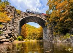
The rail line between Boston and Albany dates back to the birth of American railroading in the 1830s. Its construction was fueled by the economic rivalry between New England and New York exacerbated by the opening of the Erie Canal in 1825. Today, a new effort is underway to better link Albany and Boston by passenger rail.
Despite Massachusetts being home to some of America’s first canals, building a water route across the Berkshires was impossible so the Bay State turned to the emerging railroad technology to bypass the city of New York and Hudson River route and secure for themselves a direct trade route to the west.
The Boston & Worcester Railroad, chartered in 1831, was one of New England‘s earliest railroads. When it fully opened in 1835, it covered about 45 miles between the two cities.
The Western Railroad was chartered in 1833, with the ambitious plan to conquer the Berkshires.
Building a continuous rail line over the mountains in the late 1830s was considered an impossible task due to the steep grades, but the Western closed the gap to the New York state line by 1841.
To combat the 1.8% mountain grade toward Pittsfield, the railroad had to station heavy, specialized “helper” locomotives in Chester, Massachusetts to pushed heavy trains from behind to give them enough power to scale the summit.
Upon reaching the New York line, the Western Railroad leased the Albany & West Stockbridge Railroad, finally opening a single route to the Hudson River in December 1941.
The combined chain of railroads between Boston and the Greenbush (now the city of Rensselaer) on the Hudson River formed what is believed to have been the longest and most expensive rail line in the world.
Or they traveled north to Troy via six miles of track of the Troy & Greenbush Railroad, finally constructed in 1845–1846.
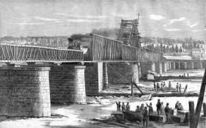
This technically allowed rail travel between Boston to Buffalo, by way the covered Troy-Green Island Railroad Bridge in Troy which required cars cross be horse-drawn.
In 1851 the Greenbush-Troy line was leased to the Hudson River Railroad, which later came under the control of Cornelius Vanderbilt and merged into the New York Central Railroad, the company which consolidated the individual railroads between the Hudson River and Buffalo in 1853.
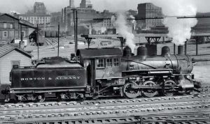
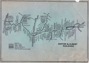
To more efficiently run the three disconnected lines between Boston and Greenbush, the companies merged on September 4, 1867 to form the Boston & Albany Railroad (B&A).
In the late 19th century, the railroad hired Henry Hobson Richardson to design stone passenger stations along the route, helping to standardize the railroad’s corporate identity.
The New York Central and Post-War Decline
In 1900, the much larger New York Central & Hudson River Railroad leased the B&A for 99 years. While the B&A operated as a subsidiary and kept its historic branding in New England, its independence was effectively over.
Like most American passenger rail lines, the B&A fell on hard time with the rise of the automobile, and especially after the Second World War with the building of the interstate highways and expansion of commercial aviation.
In 1968, the New York Central merged into the ill-fated Penn Central Transportation Company, which collapsed into bankruptcy just two years later.
On May 1, 1971, the newly formed Amtrak assumed control of long-distance passenger travel along the corridor. However, intercity service west of Framingham was temporarily discontinued in 1975 due to a lack of willingness of the state to subsidy the line.
In the meantime, freight infrastructure passed from Penn Central to Conrail in 1976, and was acquired by CSX Transportation in 1999.
The Boston-Albany Corridor Project
Today, the rail line between Albany and Boston remains heavily utilized by CSX freight trains, the MBTA commuter system, and Amtrak’s daily Lake Shore Limited.
Massachusetts’ ongoing Boston-Albany Corridor Project is working to restore the high-frequency intercity service that the original Boston & Albany Railroad spent the 19th century building.
Among the challenges is how to insert fast passenger rail onto tracks owned and heavily utilized by CSX freight trains. To solve this, MassDOT, Amtrak, and CSX are planning targeted infrastructure modifications:
The Pittsfield Track Capacity Project is expected to eliminate delays on Amtrak’s Lake Shore Limited and Berkshire Flyer by installing a new three-mile siding track in Richmond (near Pittsfield) and a new track switch. This will allow passenger trains to bypass parked or slow freight trains.
The Project is also exploring double-tracking and curve modifications along the “Inland Route” (the Springfield-to-Worcester section) to increase speeds. There are also plans to add modern Positive Train Control (PTC) and enhanced signaling to coordinate high-density freight and passenger traffic on shared tracks.
A second platform is being considered for the Pittsfield station to reduce congestion there and new station is being considered for Palmer, Massachusetts.
At present, it is assumed station stops will include South Station and Back Bay in Boston, Framingham, Worcester, Palmer (the proposed station), Springfield, Pittsfield, and Albany-Rensselaer.
In December 2023, the Boston & Albany Corridor was accepted into the Federal Railroad Administration’s (FRA) Corridor ID Program and MassDOT was awarded $500,000 to scope a Service Development Plan, which the FRA has since approved the scope, schedule, and budget for.
The Service Development Plan will study how passenger rail service on the Boston and Albany Corridor would operate and identify the steps needed to get there.
Last August, the US Department of Transportation announced Step 2 funding for the Boston & Albany Corridor through the FRA’s Corridor ID Program.
The announcement identified over $3.5 million in the award to be matched with $395,000 from MassDOT. This funding will be used to support the Boston-Albany Corridor Service Development Plan.
Upcoming Public Meeting
MassDOT is hosting a virtual public information meeting on the Boston and Albany Corridor Service Development Plan on Tuesday, October 6, from 6 until 7:30 pm. The meeting will be held virtually via Zoom.
Written questions and comments submitted through the Zoom Q&A feature will be read aloud and responded to at the end of the presentation, as time allows. A Q&A summary will be posted to the project website after the meeting.
For individuals who are unable to attend, a meeting recording will be posted to the project website. Comments and questions may be submitted anytime to bostonalbanycorridor@dot.state.ma.us.
THE ANNUAL TRIBA EVENT IS COMING UP….STAY TUNED FOR REGISTRATION INFO.
PHOTO OF THE DAY
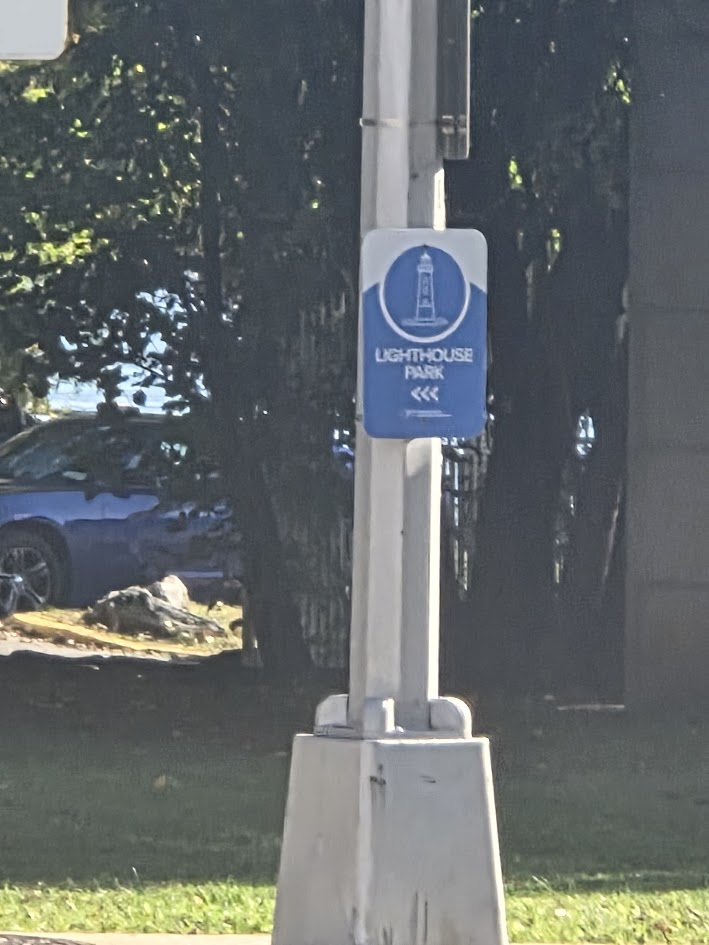
Finally, a sign leading to the lighthouse COULD IT HAVE BEEN SMALLER? REALLY. RIOC
CREDIT
NEW YORK ALMANACK JUDITH BERDY
All image are copyrighted (c) Roosevelt Island Historical Society unless otherwise indicated THIS PUBLICATION FUNDED BY DISCRETIONARY FUNDS FROM CITY COUNCIL MEMBER JULIE MENIN & ROOSEVELT ISLAND OPERATING CORPORATION PUBLIC PURPOSE FUNDS.
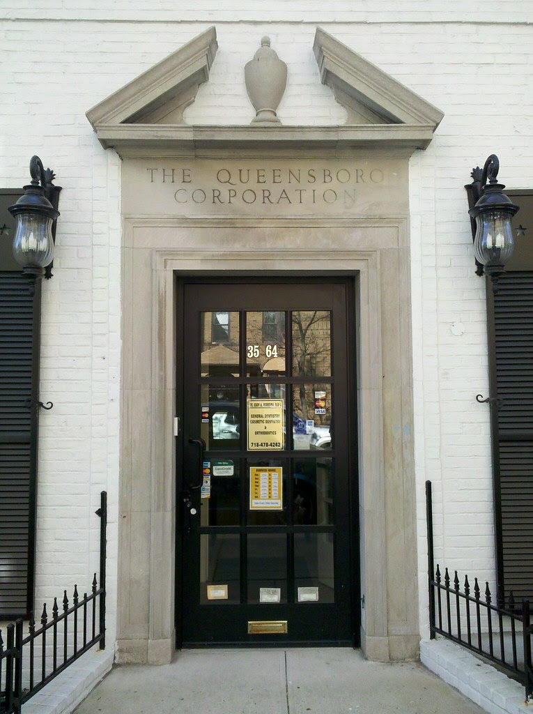
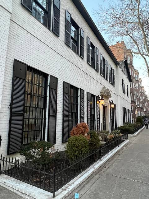
AS I WALKED ALONG 37TH AVENUE IN JACKSON HEIGHTS THIS BUILDING STOOD OUT AND REMINDED ME OF THE HISTORY OF THIS UNIQUE COMMUNITY.
The Queensboro Corporation was a real estate company that was almost solely responsible for the growth and development of this area of northern Queens. The Corporation, formed by local North Queens businessmen in 1909, spent more than $4 million buying more than 350 plots of land between 1909 and 1914. They built residential tracks, apartment buildings, cooperative garden apartments, and were actively involved in advocating for the expansion of the subway through the neighborhood.
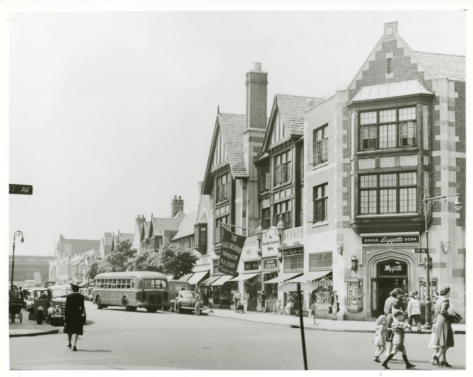
The headquarters for the Queensboro Corporation was built on the corner of 82nd Street and 37th Avenue (which was then becoming one of the main commercial thoroughfares). This Neo-Tudor building was constructed prior to 1928 and was designed in a similar style to many of the residential and commercial buildings that the Corporation was developing nearby.
The white brick and black shutters extolled the appeal of the development
The feel of an old English Town along the main shopping street
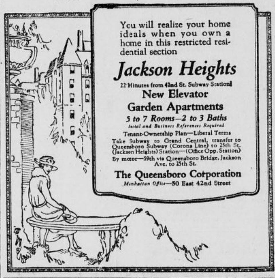
Advertising for white middle class Christian residents, the advertisements openly used the word “restricted”.
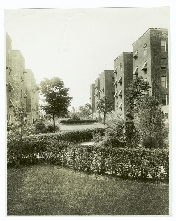
The buildings featured interior courtyards. Many of the original buildings were cooperative. Later buidings were rentals.
From Wikipedia
The Queensboro Corporation was a real estate company founded by Edward A. MacDougall that played a major role in developing the Jackson Heights area of Queens, New York City.
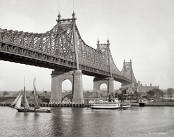
The Queensboro Corporation was formed by a group of investors from New York headed by Edward A. MacDougall.[1] The corporation was founded on August 12, 1909, with the purpose of developing the area that was then called Trains Meadow. The first land purchase of 128 acres (52 ha) was completed in 1910, and the corporation had bought about 350 acres (140 ha) by 1914. MacDougall renamed the area Jackson Heights, after Jackson Avenue (now Northern Boulevard), the main east–west road at the time. There were no prominent “heights” in the area, but the word was presumably chosen to denote social exclusivity. At first the area could most easily be reached via a ferry from Manhattan.[2] The Queensboro Bridge opened in 1909, making the area more accessible.[3]
The corporation started to energetically exploit the potential of the property.[4] MacDougall’s corporation went well beyond simply erecting buildings. It planned the community, divided the land into blocks and building lots, and installed streets, sidewalks, power, water and sewage.[5] By 1912, 8 miles (13 km) of paved roads had been built with sidewalks, curbs and gutters, and there were 5 miles (8.0 km) of sewers.[3] The elevated IRT Flushing Line reached Jackson Heights in 1917, reducing the travel time to Manhattan to twenty minutes.[6] There were four stations in Jackson Heights at 74th Street, 82nd Street, Elmhurst Avenue, and Junction Boulevard. In 1922, prompted by the Queensboro Corporation, the Fifth Avenue Coach Company launched a direct service of double-decker coaches to Jackson Heights.[3]
The target customers for the Queensboro Corporation were middle class residents of New York who could afford to live in the suburbs.[4] In 1914 the Queensboro Corporation directors inspected new housing developments in several European cities. These probably included the garden apartment projects at Charlottenburg, Berlin, built between 1904 and 1909, that Erich Kohn and Paul Mebes had designed for the Berlin Civil Servants Dwelling Association. The housing developments at Jackson Heights closely resemble the Charlottenberg developments.[7] In contrast to traditional suburbs of single-family houses, the Queensboro corporation decided to build upscale apartment buildings distinguished by shared garden spaces.[8] The apartments were of high quality with ornate exteriors and features such as fireplaces, parquet floors, sun rooms and built-in bathtubs with showers.[9] The apartments, or “homes”, were sold rather than rented under what was first called a “collective ownership plan”. This was later changed to “cooperative ownership”, probably because the first name had connotations of socialism.[8]
During the years that followed, the interests of the Jackson Heights community and the Queensboro Corporation were closely intertwined. The local newspaper sometimes sounded like the voice of the corporation. The corporation encouraged development of the commercial area that surrounded the 82nd Street subway station, and assisted in setting up a community board to ensure the growth of civic institutions.[8] MacDougall also donated land for churches.[6] Part of the model in the early years, which broke down with the Great Depression of the 1930s, was “a policy of reasonable restriction in accepting tenants thus bringing together tenants having ideals and living standards in common.” In plain English, this meant that Jews, Blacks, and perhaps Greeks and Italians were excluded from the community.[10] Only white Anglo-Saxon Protestants were welcome.[6]
Garden apartments
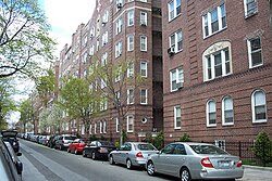
Typical residential street in Jackson Heights
The Laurel apartment building on 82nd Street at Northern Boulevard was the first of the Queensboro Corporation buildings in Jackson Heights, completed in 1914. The building included a small courtyard. The Greystones on 80th Street between 35th and 37th Avenues were completed in 1918. The architect George H. Wells designed the Greystones, for which the Queensboro Corporation coined the name “garden apartment” to convey the concept of apartments surrounded by a green environment. With abundant land available, all unused space was used for parks and gardens, or for recreational areas that included a golf course. This was used in initial marketing efforts, although later much of the land was built upon.[11] In 1919 the Corporation introduced the concept of cooperative ownership to strengthen the sense of community.[12]
On August 28, 1922, the Queensboro Corporation paid $50 to the WEAF radio station to broadcast a ten-minute sales pitch for apartments in Jackson Heights.[13] This may have been the first “infomercial“, opening with a few words about Nathaniel Hawthorne before promoting the corporation’s Nathaniel Hawthorne apartments.[14] Mr. Blackwell of the Queensboro Corporation then urged his audience to:
seek the recreation and the daily comfort of the home removed from the congested part of the city, right at the boundaries of God’s great outdoors, and within a few minutes by subway from the business section of Manhattan … The cry of the heart is for more living room, more chance to unfold, more opportunity to get near Mother Earth, to play, to romp, to plant and to dig … Let me enjoin upon you as you value your health and your hopes and your home happiness, get away from the solid masses of brick … where your children grow up starved for a run over a patch of grass and the sight of a tree…[15]
The Queensboro Corporation employed the well known architect Andrew J. Thomas, already an advocate of garden apartments. Some of Thomas’ most important work was undertaken for the corporation. The first example was the Linden Court complex, in the block formed by 84th and 85th Streets and 37th and Roosevelt Avenues.[16] The buildings in this complex are in attached pairs around the perimeter of a shared open space holding a landscaped garden, with gaps at regular intervals in the perimeter wall. The layout provides light and ventilation to the apartments, and fosters a sense of belonging to a community.[17] Linden Court was the first development to include parking spaces, with single-story garages accessed via narrow driveways.[18]
Thomas built variants on the Linden Court design aimed at upper-middle income customers with the Château and Towers projects. Sold as cooperatives, both of these 34th Avenue developments had large, airy apartments and were served by elevators.[16] The elegant Château cooperative apartment complex was built in French Renaissance style. The twelve buildings surround a large common garden. They have slate mansard roofs pierced by dormer windows, and diaperwork brick walls.[19] The early gardens were designed only to be looked at. As the concept of the garden apartment evolved, and the garden areas became relatively larger compared to the built areas, the design of the shared gardens began to include paved spaces where people could meet or sit.[20] In 1924 the Queensboro Corporation started the Ivy Court, Cedar Court, and Spanish Gardens projects, all designed by Thomas.[21]
Later developments
In the mid-1920s the Queensboro Corporation also built attached and semi-detached homes for single families, with brick facades in American Colonial or English Tudor styles.[22]
In response to the ten-year Depression that followed the Wall Street Crash of 1929, the corporation tried to rationalize private enterprise through the Jackson Heights Merchant Association, and to spin off responsibility for maintaining infrastructure to the private sector. Formerly exclusive apartment buildings were opened to lower income groups, with apartments divided into smaller units and rooms rented. Jackson Heights lost its exclusive character, and would not regain it.[10]
After a severe drop in property values in the early 1930s, the Queensboro Corporation struggled financially throughout the decade. To raise money, the corporation began to build on land that until then had been kept open for community use, including the golf course, tennis courts and community garden.[23] The corporation also began erecting traditional six-story apartment buildings. Dunolly Gardens, the last garden apartment complex that Thomas built, was an exception, a modernistic building completed in 1939.[22] The corner windows, considered very innovative in the 1930s, gave the apartments a more spacious feeling.[24]
Edward A. MacDougall died in 1944 and was succeeded as president of the Queensboro Corporation by his son, A.E. MacDougall, who wrote in the September 1944 Jackson Heights News that “As soon as [wartime] restrictions are lifted by the Government, Jackson Heights will be ready to provide the most attractive types of garden apartments in close proximity to the center of Manhattan.”[25] In 1947 the New York City Housing Authority tried to develop public housing in Jackson Heights. The local residents rejected proposal.[26] In the 1940s the Queensboro Corporation sold much of its land to private developers.[27] The Queensboro Corporation completed the Carlton House in 1947 and advertised the apartments for sale on a cooperative basis. Response was poor, and the corporation instead started to rent the apartments. In 1949 the corporation launched the Greenbrier, the last cooperative the Queensboro Corporation was to sell in Jackson Heights.[25]
PHOTO OF THE DAY
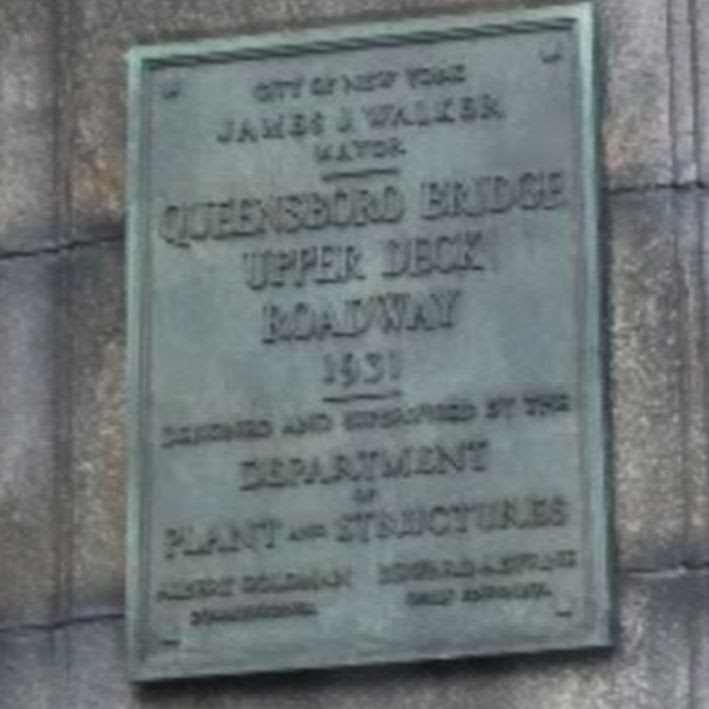
The Upper level 58th Street Entrance to the 59th Street Bridge.
CREDIT
WIKIPEDIA JUDITH BERDY
All image are copyrighted (c) Roosevelt Island Historical Society unless otherwise indicated THIS PUBLICATION FUNDED BY DISCRETIONARY FUNDS FROM CITY COUNCIL MEMBER JULIE MENIN & ROOSEVELT ISLAND OPERATING CORPORATION PUBLIC PURPOSE FUNDS.

&mc_cid=491b07c862&mc_eid=UNIQID)